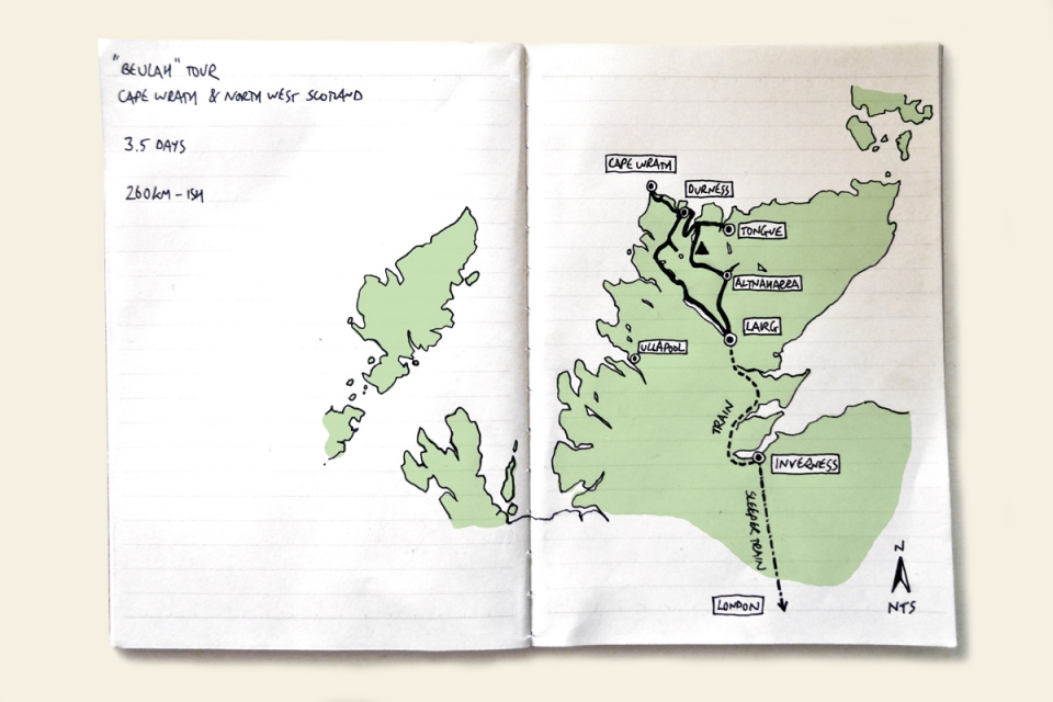
The seeds for this trip were sown across two bike tours: first – our Lost Lanes Overnighter, when I (Stefan) found a beautiful 1971-75 OS Second Series 1:25,000 map sheet of Cape Wrath in an old Hay-on-Wye bookshop and, more recently, during our Exmoor 200 ‘AAA’ Weekender when Will from Brother Cycles mentioned that he wanted to take their soon-to-be-released 29er – ‘the Big Bro’ – on a testing voyage before tackling the Tour Divide. The best trips and ideas are forged on the road – the perfect time to think, to dream, and get to know people. I had this journey I’d been longing to ride in my mind, and by the end of the Exmoor tour, Will and I decided to travel to the very north-westerly point of the UK via the ‘Cape Track’ and explore her wild surrounds by bike together.
Jordan (photographer) and Luke (filmmaker) were thankfully keen to join us, making the magic touring collective number of four. Our meeting place: B1866 – the Brooks shop in London, one Thursday evening. Our start-point: Lairg on the Friday lunchtime, after taking the Sleeper Train 900kms-ish to Inverness…
Beulah [n]
land of paradise; religious paradise
THE BLESSING OF THE ROAD
May the hills lie low,
May the sloughs fill up
In thy way.
May all evil sleep,
May all good awake,
In thy way.
The Road to the Isles | Kenneth Macleod


There is nothing like waking up even more tired when you know you’ve got three big days ahead. Not even the gentle rumble of the train or collection of empty single malt glasses on our tray tables from the liberal tasting in the next carriage along, had helped me on the sleep front. However, the bonus of waking up on a sleeper train is looking around at how ridiculous your carriage companions look catching flies with their complimentary eye masks on. Will and Jordan were no exception; Luke was already up filming the stunning sunrise behind us as we sped north through the Cairngorms. Soon enough I joined him awake (sort of), excited to be immersing ourselves in the wilds of Scotland and, touch wood, for future sunrises and sunsets like this over the next three days. Note: if there is one reason not to wear an eye mask, it is the danger of missing out on waking up to a carriage flooded with the deep orange glow and warmth of a 5.00am sunrise. Magic.
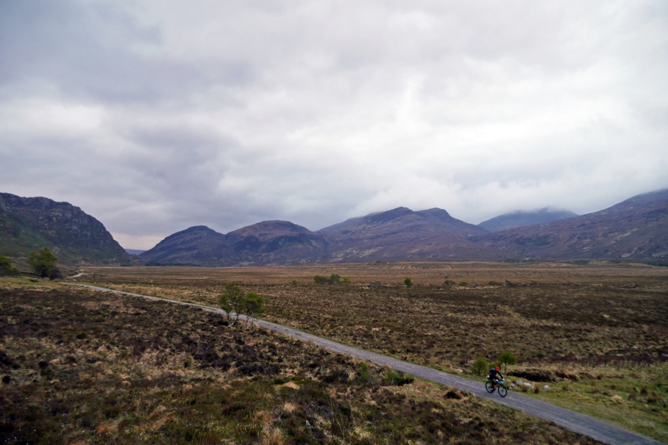
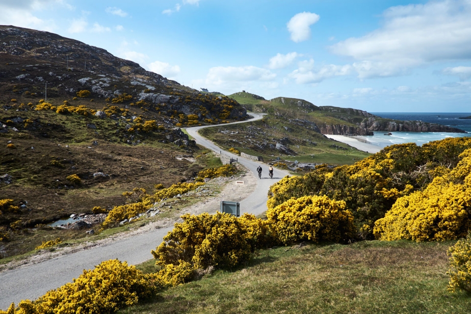
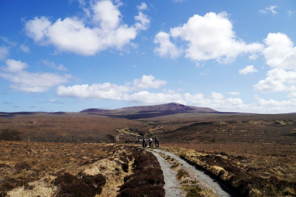
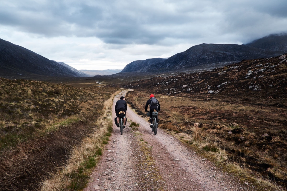
Ever since finding that old OS map sheet of the Cape Track – a route originally built in the 19th Century to provide access to the much-needed lighthouse at Cape Wrath – I had begun working out the most efficient route for a 3-4 day tour; seeking out the special roads that would complete a circular journey to the Kyle of Durness, where the ferry that took us and our bikes to the start of the intriguing ‘U70’ track would be moored up and waiting. Using public transport to make the most of our time on the bikes, Lairg was the furthest north we could get on the train, making it the ideal gateway for a 260kms-ish journey to the most north-westerly point of the UK, feasible even at our 10mph (sometimes 10kmph) touring average.
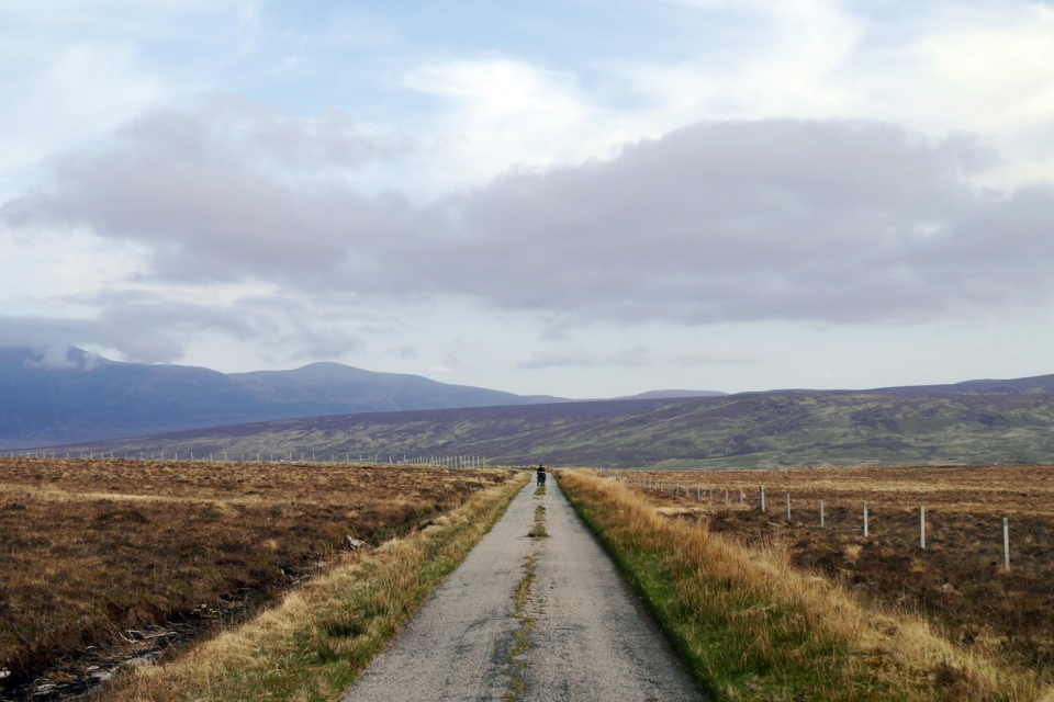
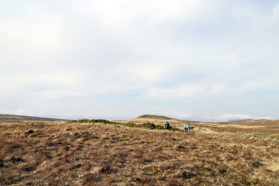
Once disembarked at Lairg train station, following a quick toast to the road ahead, it was straight onto single-track roads that were empty but for stampeding logging trucks; an escape route for us, this was the same ol’ boring commute for the truckers. Our aim for the afternoon was to reach Tongue on the north coast and so, with only 80kms to ride, when a stunning new valley opened up or riverbank looked inviting enough, the four of us took the opportunity to pause for a break – for a sit in the sunshine and a fresh coffee, or gorse tea. Gorse was plentiful in such sweeping moorland landscapes, and the pungent roadside coconut aroma from the bright yellow flowers was the Highland’s equivalent to those regular wild garlic hits on a typical Spring Tour. We continued north, making the obligatory stop-off at the remote Crask Inn, enjoying the quiet road that skirted around Ben Hope and along the eastern shore of Loch Hope, before riding across the Kyle of Tongue causeway to the hostel as the daylight went; each of us fuelled by an emergency spoon of Nutella with 12km to go.
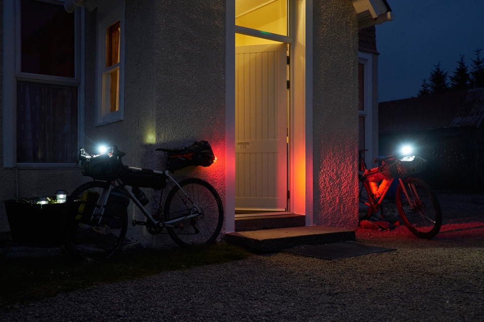
Pannier Tours are about escape; leaving daily life behind and heading off into the unknown. The overnight sleeper, then local train up to Lairg, and immediate quiet single-track roads made for the ideal acclimatisation on Day One. We further phased our disconnection with the choice of shelter each evening – the four of us started off dorm-ing on the first night in Tongue hostel: a lively hub for journeying folk touring the North Coast 500, LEJOG and the Scottish Highlands, before bothy-ing at Kearvaig Bay on the Cape, and then wild camping in the Dionard Valley on our last night.
..."we phased our disconnection with the choice of shelter each evening - the four of us started off dorm-ing, before bothy-ing at Kearvaig Bay and then wild camping on our last night."
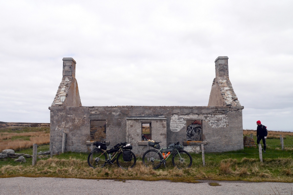
Shieling [n]
once shelters in remote places that now stand derelict, largely because the movement of livestock has ceased
Uncommon Ground | Dominick Tyler


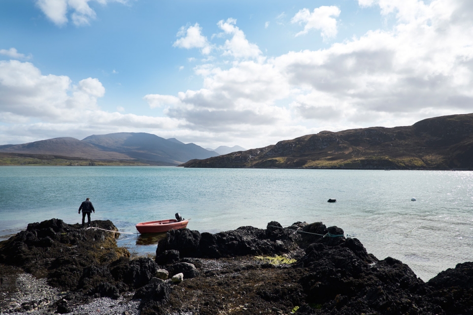
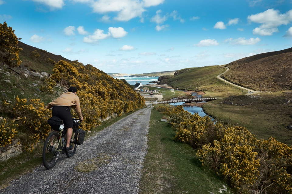
Aeropress x Break Fluid coffees and porridge portions were the order of the morning as we packed our bikes overlooking the white sand spits and open sea to the north. Before long, we were ready to roll straight onto the North Coast 500 route headed for the journey’s critical checkpoint: Keoldale, 2-3kms south of Durness. The little slipway there is where John operates his ferry service across the Kyle of Durness to the Cape Wrath headland; the start of the 18kms Cape Track that carves through 25,000 acres of isolated moorland to the Cape Wrath lighthouse. This track, and our exploration off it, was set to be the main feature and highlight of the trip. The bleak-sounding name ‘Wrath’ for the headland actually derives from the Norse word ‘Hvarf’ meaning “turning point”, for it was here the Norsemen turned their ships to head home.
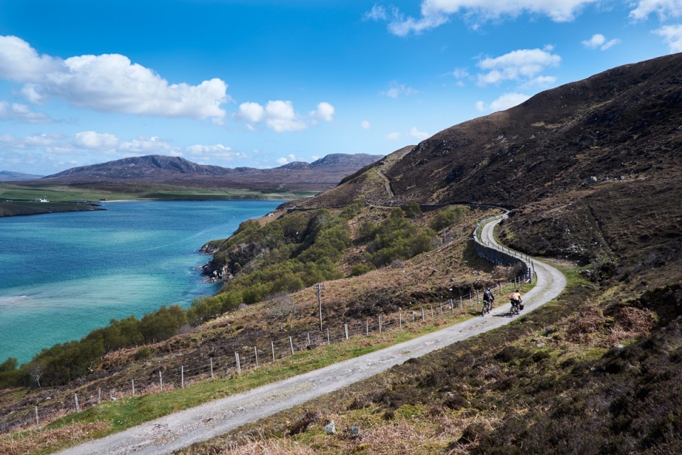
Casting off in John’s boat – Beulah – across the Kyle of Durness*, it would be easy to assume that the Cape headland is an island of sorts given the sense of detachment from the mainland. It isn’t by any means, and if you look closely at an OS Explorer map, you’ll notice a footbridge or two just at the head of the Kyle that provide access to the headland. However, the moorland terrain is treacherous and a real challenge; we’d looked at this as an option if we couldn’t get the ferry over
but having now been, we couldn’t advise this as a route option – the Cape’s remoteness and rugged terrain effectively renders a southern border with the mainland. The only more official through route (though still unmarked) is via Sandwood Bay and the Cape Wrath Trail on the west coast, which has a reputation for being the toughest walking trail in the UK, and was a route option back to Lairg I had eyed up had we more time for the trip, and no doubt more patience.
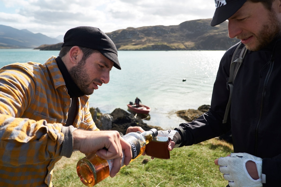
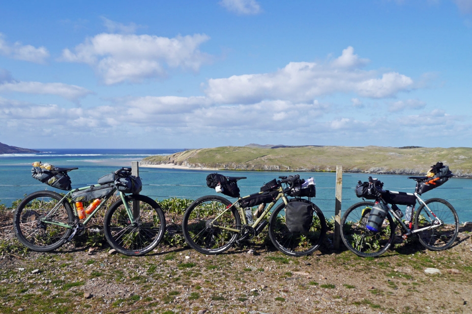
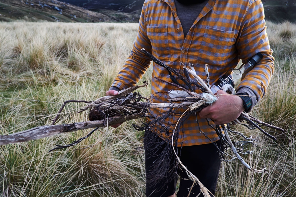
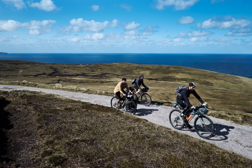
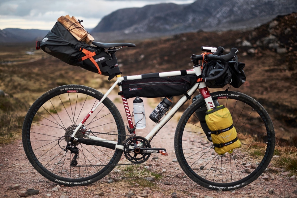
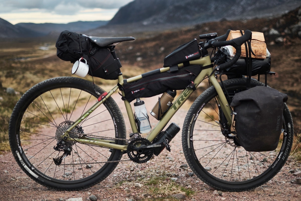
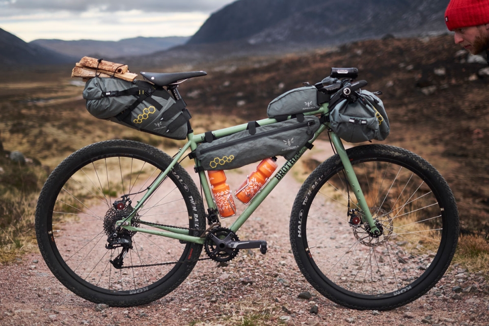
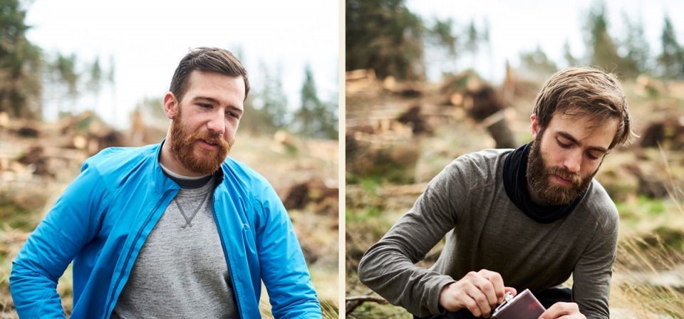
Will and I were riding 29” x 2.2” tyres, whilst Jordan and Luke were on 700c x 35mm. Both setups were fine for the mix of tarmac / gravel / off-road we rode, although it was fun to take the 29ers off the beaten track a bit further, and quicker; the loaded 35mm’s meant riding a bit more cautiously when severe rocky ground took hold at points. While Will was out testing the new Brother Cycles’ 29er on this trip, we were also taking the new Ortlieb bikepacking bags on their first proper outing, and it was all looking positive – Jordan had everything he needed on him for an unsupported adventure, including his main camera in the easy access Accessory Pack, and the weight of firewood strapped to the top of the Seat Pack. He even had a bottle of Glengoyne stowed, with help from the extra space provided by the Revelate Tangle Framebag.
"...it would be easy to assume that the Cape Wrath headland is an island of sorts ... The Cape's remoteness and rugged terrain effectively renders a southern border with the mainland."
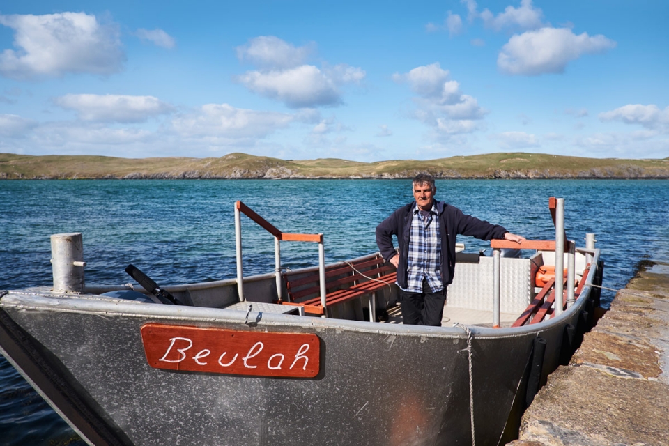
“Have yous seen the name of the boat? The very first boat I ever had, a wee lobster boat, was called the Beulah, so I decided to call this one Beulah too. It means 'mystical place, religious paradise, land of paradise'...yous are off there now..."
Marfer [n]
the grassy borders to lanes and tracks. A mid-marfer is the vegetated section along the centre of a track, that signals heading somewhere remote.
Uncommon Ground | Dominick Tyler
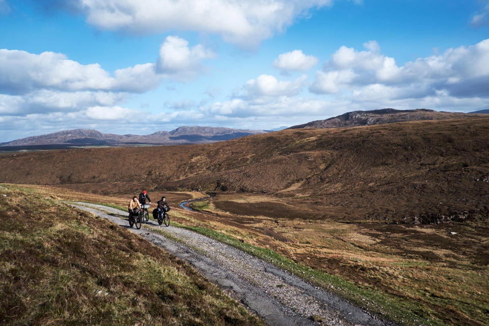
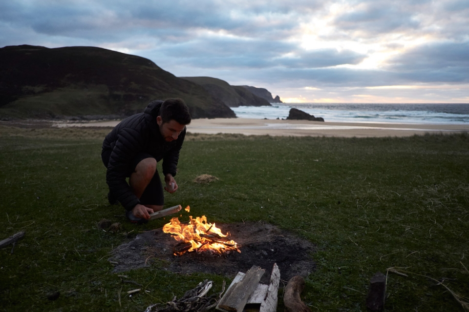
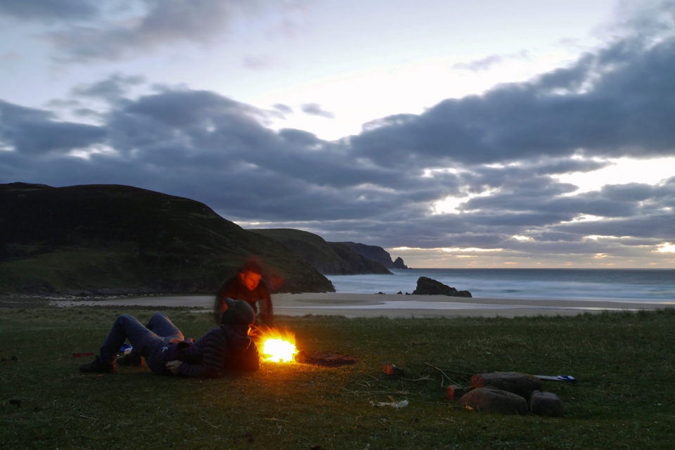
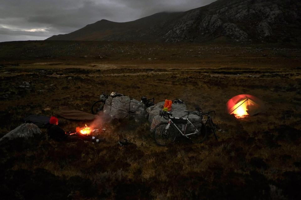
The Cape Track was everything I’d envisioned it to be, snaking through such a humbling, desolate landscape past all the lochs and crossing all the contours I could recognise from the old OS Second Series map sheet. The only thing not marked on the old map were the Ministry of Defence (MOD) Sentry Points dotted at key points along the track’s 18km path. The MOD own vast swathes of the Cape, running it as a live training & firing range for land, air and sea forces**. During exercises the range is termed active, and access is restricted at these Sentry Points: the chequered huts were the most striking installations in an otherwise bleak, isolated moorland wilderness. Even in the afternoon sunshine, it was clear to see how suitable this empty expanse is as a training range – in bad winter weather it would most definitely test the strongest of souls mentally and physically. We, on the other hand, had the relative comfort of Kearvaig Bay to aim for that night, where there would hopefully be a bothy, beach, sunset, campfire meal and, at the very least, a dram to look forward to…
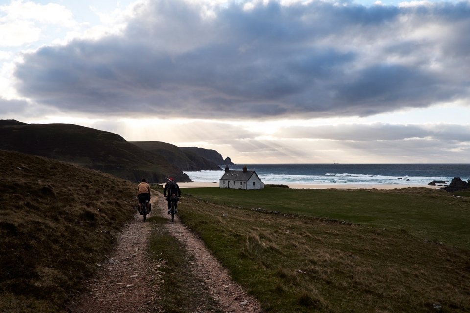
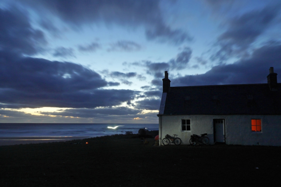
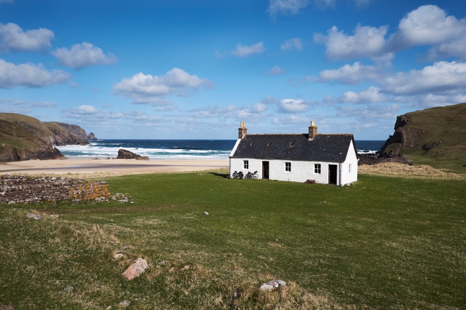
After 10-12kms of awesome riding along the track, we came to a shipping container and the Kearvaig junction which signalled our turning down a steep rocky river valley track to sea level. Sure enough, the roofline of the most picturesque bothy, perched in the most special of locations, gradually revealed
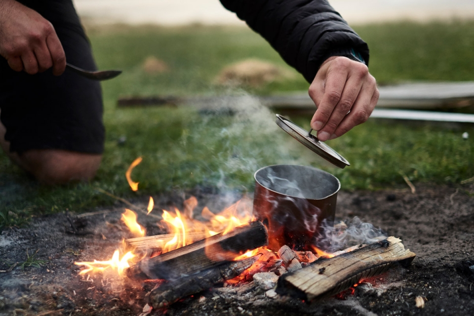
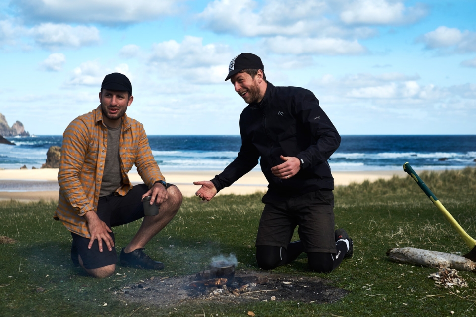
itself as we neared the wide sandy bay. While we’d proactively picked up some firewood as we rode throughout the day, it felt so satisfying to prop the loaded bikes against the bothy wall and head off on a leisurely-paced driftwood hunt across the bay to top up our woodpile as one of us got the fire started. Once we’d enjoyed several pots of posh pesto / salami / mushroom pasta and Forestia meals outside, the skies darkened (which, for this far north at this time of year, meant it was around 11.00pm) and so we moved a small pile of the glowing embers, using the on-hand (clean) toilet trench spade, inside to the ‘west wing’ fireplace and carried the night on in there. Bothies are special and incredibly useful places.
Located across remote parts of the UK, the Mountain Bothy Association (MBA) ensure the upkeep of 100+ bothies – basic, remote buildings that have fallen out of use, but are useful as shelters for travellers – join them as a member. For those who have never seen or used one, think of it as camping without the need for a tent; “assume there are no facilities – no tap, no sink, no beds, no lights, and, even if there is a fireplace, perhaps nothing to burn. Your comforts have to be carried in; you’ll learn what’s useful as you go along.” There is a Bothy Code of Conduct*** but essentially – be nice, tidy, and prepared to replace anything you use for the next travellers.
"While we'd proactively picked up some firewood as we rode throughout the day, it felt so satisfying to prop the loaded bikes against the bothy wall and head off on a leisurely-paced driftwood hunt across the bay to top up our woodpile..."


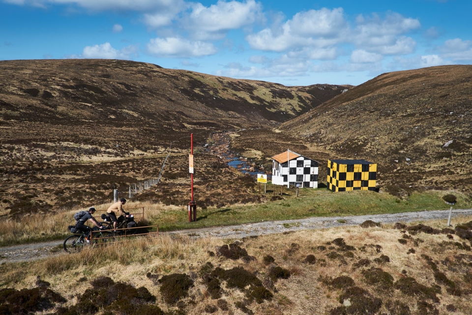
"...the chequered huts were the most striking installations in an otherwise bleak, isolated moorland wilderness"
Of course, the lighthouse at Cape Wrath was a psychological beacon and a must reach for us, but a Pannier Tour is about the journey more than anything, so our arrival at the lighthouse was always going to be something of a non-event. Following a special morning at the bothy, originally woken by the roaming sheep (evidence of the ruined crofting hamlet in the bay still exists) and crashing waves, we were all far too content to not set off early doors, choosing to brew coffees and cook breakfast on the outside fire as we overlooked the sunlit Stack Clò Kearvaig. Eventually the four of us tore ourselves away from the special bothy location and finished riding the main track with the sun beaming behind us, sparkling blue ocean to our left, desolate moorland around us, and remotest of lighthouse complexes ahead of us. The lighthouse was designed and built in 1828 by Robert Stevenson, for the Lighthouse Commission who needed to signal such a significant point: the most north-westerly point on the British mainland and some of the most dramatic coastline / highest cliffs on the isles, some of which rise to 281m above sea level. The amazing Cape Track was originally built to serve the lighthouse and since, additions to the lighthouse complex – a Coastguard and Logging station for monitoring passing ships & cargos – have been built; both brutal structures that still survive yet lie derelict around the white lighthouse buildings.
Apart from the canteen-style cheese and pickle sandwiches, hot instant coffee, the fact they still served Wagon Wheels, and several interesting conversations with walkers who had just completed journeys along the Cape Wrath Trail, there wasn’t a lot to report from our vacuous end point and so we finished up at the Ozone Café and were all set out to honour our promise
to John (the ferryman) that we’d be back for a lift at 2.00pm. We liked John.
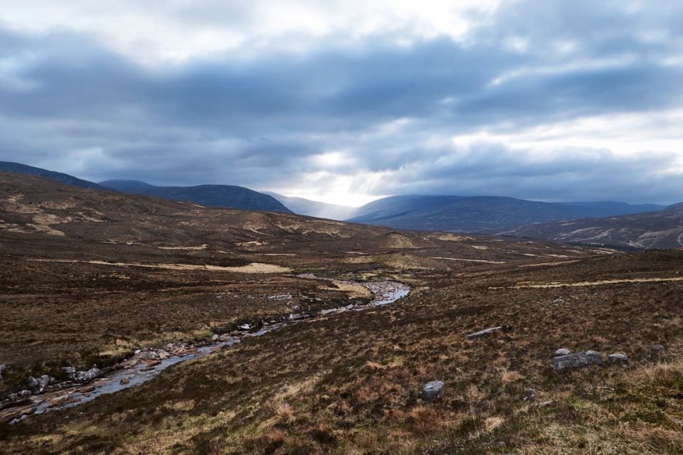
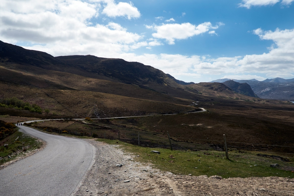
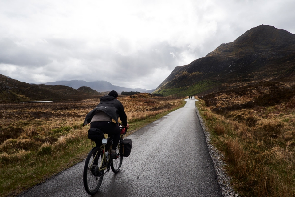
Landing back on the eastern shore of the Kyle of Durness meant we were effectively on the final leg back to Lairg, but we had one more off-road stretch in mind – heading off the main road and up into the Dionard Valley to find a spot to wild camp in the middle of nowhere on our last evening. We backtracked to Durness to stock up on a few supplies, including food and some firewood chunks, thanks to a local who understood our lust for a campfire and offered us some from his personal store. From there, we were back on the North Coast 500 route but, while clocking up some kms on the smooth tarmac, the grey skies rolled in and cast an eerie tone over the valley we were heading into; this was the Scotland I was more familiar with. After pursuing a modest campfire and good laugh in the drizzle, Will and I set ourselves for a no-less-enjoyable damp, chilly night in the bivvy bags whilst Jordan and Luke shared the relative luxury of the Hubba Hubba tent.
The adverse weather continued all night, and into the morning, so we struck camp quick****, and headed off early on the 80kms-ish ride back to Lairg for the train to Inverness, and ultimately our sleeper train back to London on Sunday night. With more time to spare, we would have taken in some of the forestry track detours, but the ‘direct’ route that hugged the loch shores still made for a special ride.
Back at Lairg station, we cracked open the bottle of Pannier Route Beer I had carried and saved for this moment. Boy did it taste good; even if it did signal that our journey was all but over…
"...we were back on the North Coast 500 route but, while clocking up some kms on the smooth tarmac, the grey skies rolled in and cast an eerie tone over the valley we were heading into; this was the Scotland I was more familiar with"


Pedalling our separate ways through the London Monday rush hour traffic was a surreal comedown from a special 3-4 day trip in the UK. The four of us shared memories of a really enjoyable yet challenging bike trip together; a real Pannier Tour.
Safe roads…
Look out for our short film on the trip, coming soon. And, in the meantime, for any information or help with kit please get in touch with us – basecamp@pannier.cc
Do sign-up in the website footer to hear from us about Pannier News, Tours and Events.
________________________________________
NOTES.
This route covers some fairly remote areas – there is potential to not see a café, establishment, or even house for many kms. Make sure you have adequate food and water (or water filtration) supplies.
*Durness Ferryman, John, caters for the tourist minibus service primarily, but be nice to him and he’ll help you out…
**Cape Wrath Range notices are released by the MOD on a monthly basis, which inform you when there will be MOD activity. Call them ahead to check before a visit.
***Mountain Bothy Association (MBA) Code of Conduct: Respect Other Users; Respect the Bothy ; Respect the Surroundings; Respect Agreement with the Estate; Please observe any restrictions on use of the bothy; Respect the Restriction On Numbers. For more detail, see the MBA website.
****Whoever stumbles across where we wild camped; you will likely find the equivalent of a travelling cyclist’s pot of gold: a whole breakfast madeira cake we annoyingly left perched on a rock, by mistake. Trust us, we were devastated on a ‘leave no trace’ and fuel level.