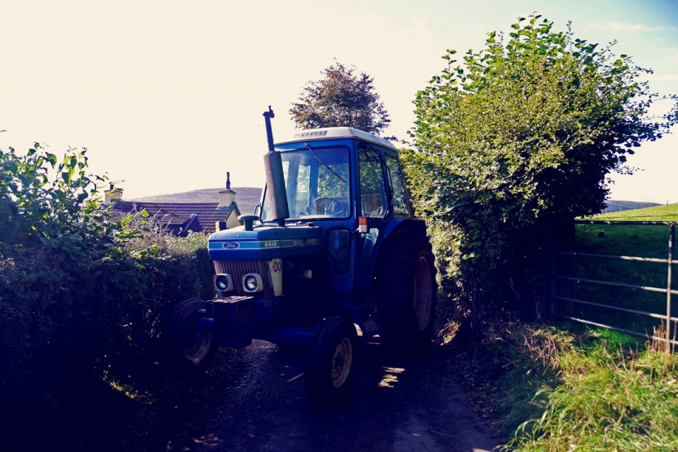
To celebrate the launch of Jack Thurston’s new touring book – Lost Lanes Wales – Stefan jumped on a train to Abergavenny (south-east Wales) with his touring bike loaded with kit for an Overnight tour and the Welsh weather. The aim was to spend an evening with Jack bivvying on the banks of the River Usk, near his hometown, before setting off North to ride three of the book’s routes: a 155km Overnighter exploring the Lost Lanes of the Black Mountains…
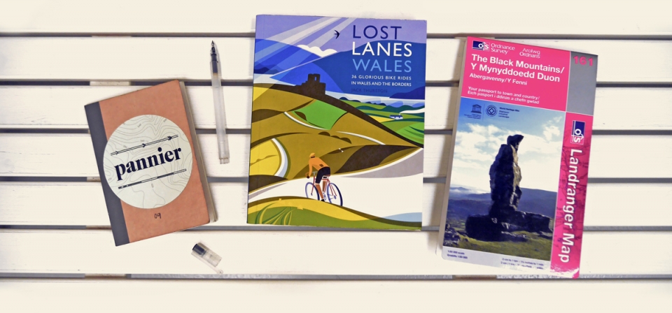
Planning a cycle tour is the next best thing to touring itself: visualising the roads ahead from the map features and relishing the opportunity to climb some chevron marked roads. For this tour, alongside the standard sketchbook and OS map, it was great to have Jack’s Lost Lanes book to plan our Overnighter route. I am a stickler for seeking out the quiet yellow roads on the 1:50,000 OS Landranger map so was happy to follow his recommended routes with some slight editing and stitching; he has already done all the hard work. After route highlighting, it was a case of noting down some of his points-of-interest en-route and setting off to meet him in Wales. I had got to know Jack previously – he penned our A History of Cycle Touring piece and I rode the Eroica Britannia with him last year, so was looking forward to catching up…
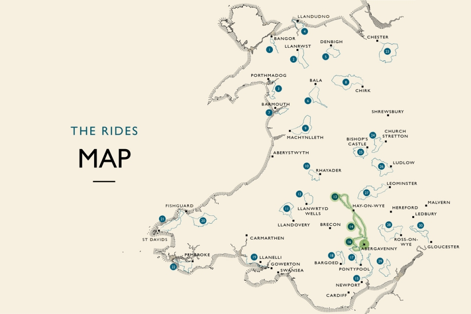
The 36 rides in the book are well organised by region, length, terrain, and grading so you can choose routes to suit your touring interests. In addition, Jack includes a section of “Best for…”s which would make it even easier for you foodies, wild swimmers, or wild campers to decide upon particular routes.
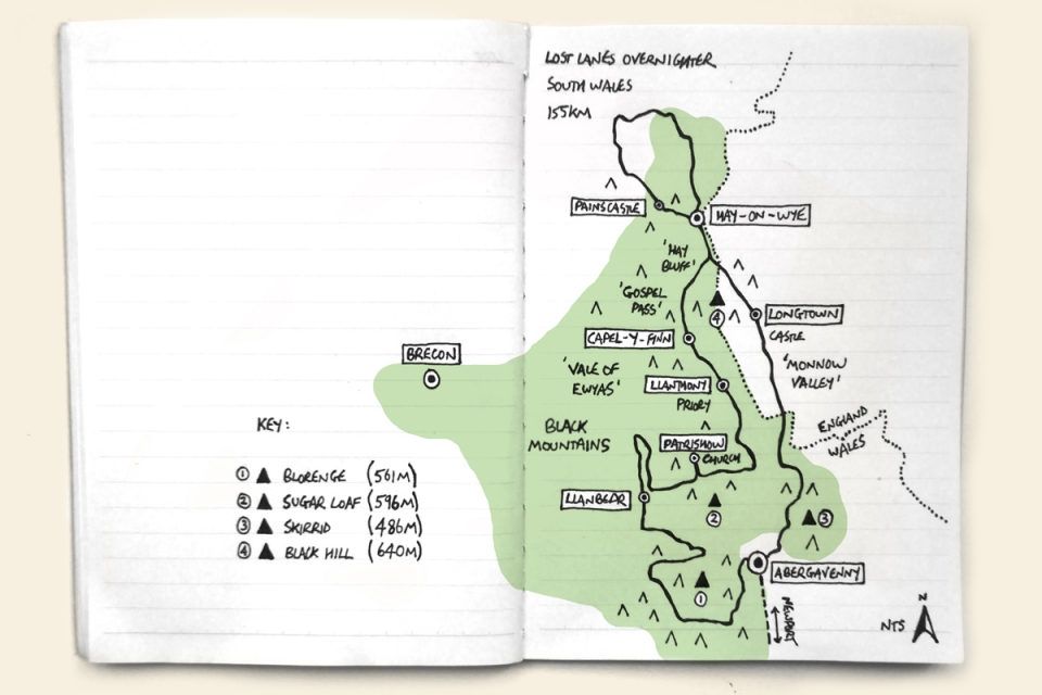
Jack has defined all of the routes to be between 30 and 75km on purpose so that they can be used as day rides, short overnighters, or creatively stitched together (as we have done) to curate our circular tour from Abergavenny. The 3 routes we combined were:
13 – Kilvert’s Hills
14 – Around the Black Hill
16 – Three Peaks
which are amongst Jack’s “Best for”: wild camping; gourmets; weekends away; ups and downs; arts & culture; and natural wonders.
The book provides useful links to GPS files for all of the routes, so as even Jack says, “don’t pack Lost Lanes in your panniers” – use it as an inspirational and insightful guide for planning your own cycle journeys. Note down the routes and points-of-interest along the route on the OS map, or in a sketchbook and then leave the book at home, or on the coffee table for others to use.
____________________
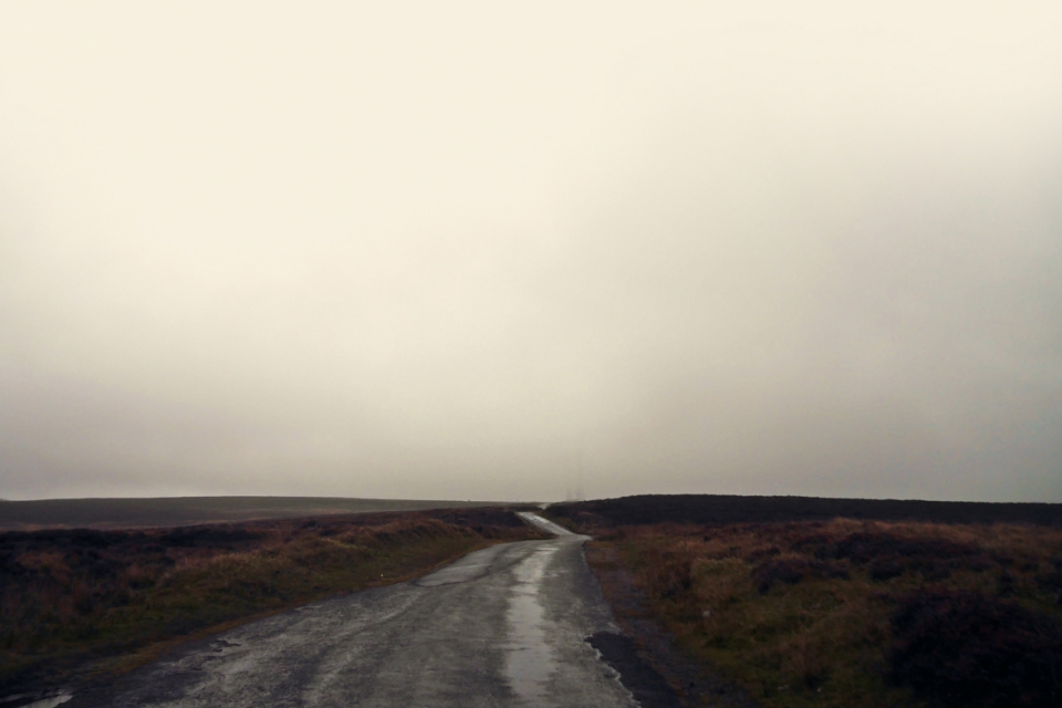
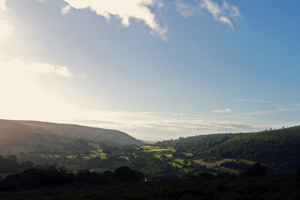
Talk about the calm before the storm: peering out of the window as the train pulled into Abergavenny, I could barely make out the surrounding mountains and hills I was heading for. The rain hadn’t arrived yet but the menacing clouds suggested it might start on my first pedal strokes. Jack wasn’t free until later in the evening, which gave me a chance to start the southern-most part of the route – climbing up and around The Blorenge – one of the town’s three main surrounding peaks.
I couldn’t wait to be up in the hills.
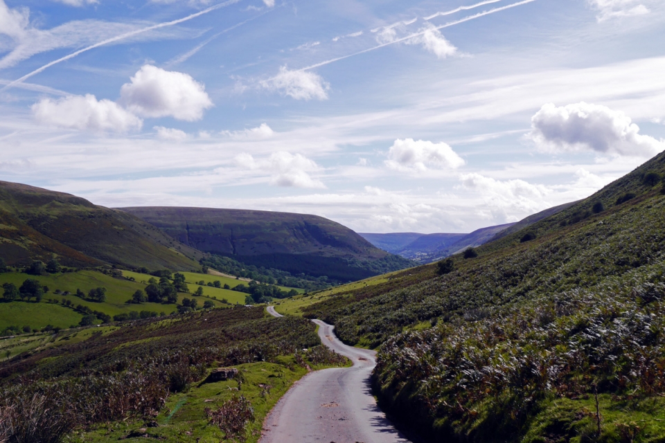
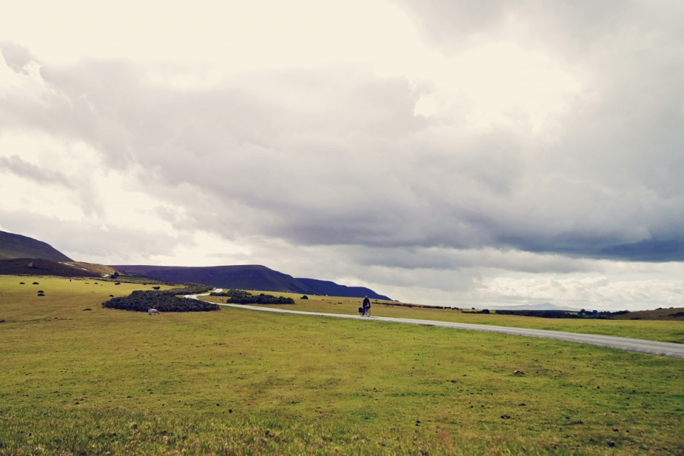
Just three hours after leaving London and I was faced with climbing the banked single-track ‘chevron’ lanes up to the summit plateau – my rear wheel desperately trying to spin-out given the gradients and wet surface. It was a challenging initiation but once the tree-line ended and moorland opened up, flying along the high empty plateau roads with the birds alongside me and overhead was a real treat; each of us exposed to a battering from the wind and rain as I aimed for the highpoint beacon – the pair of radio transmitters on the horizon. With the weather blanketing the surrounding moorland and any views, these really were lost lanes that evening…
“The old joke goes that if you flattened Wales out it would be bigger than England...the simplest way to discover Wales’s lost lanes is to follow the road uphill.”
The summit plateau of The Blorenge was a special place and I would have spent some time up there in less adverse weather – in fact Gilwern Hill was the original location for our planned bivvy that evening (a recommendation in the book) – but it made much more sense to meet down in the more sheltered Usk valley bottom. Crossing the busier ‘Tumble’ road signalled the start of the descent, down the ‘Tyla’, before the light went. This was mining and quarrying land and riding through the remains of abandoned mineworker/quarrymen villages, these glimpses into the past made me think about those who originally trod these lost lanes and trackways: “invading armies…workers heading to the mines, quarries, factories and forges…ordinary people making ordinary journeys, from farmstead to market, to church and to chapel.”
_____
The Bell pub en-route in Glangrwyney was where Jack and I met. We caught up over a beer and dried out as much as possible before seeking out a bivvy spot on the river. It was dark by now so, subtly under head-torch light, we scanned the banks of The Usk for a flat, comfy, sheltered spot. Although the weather was calm at this point, there was more rain forecast for the early hours so we made sure to get the tarp tied up and pegged out between two trees.
Under the cover of bivvy and tarp, and over a local Abergavenny pork pie, hot drink, and my trusty touring hip-flask, we talked about travelling by bike, the route ahead, Welsh place names (and their pronunciation), and Jack gave me the lowdown on his Lost Lanes Wales book…
Stefan: “Jack, you have done a great job seeking and collating this series of Welsh and Border rides in your second Lost Lanes book and I know you research-through-riding yourself. Are these all areas and roads you knew well already from previous touring exploits?”
Jack: “Yes and no. Some parts of Wales I knew very well: Snowdonia, Monmouthshire and the Wye Valley in particular. Ever since going to Snowdonia for Duke of Edinburgh expeditions at school, I have been back constantly. In the earlier days it was more often for walking than cycling, so it was an interesting challenge to work out how to get the most out of this extraordinarily beautiful National Park by touring bicycle. And then, I know the area around Monmouthshire and the Wye Valley very well, as I now live there (Abergavenny) so since moving I’ve got to know pretty much every lane and byway within 30 miles of my house…
…However, for many other parts of Wales and the Border counties of England it’s been a journey of discovery for me, which has been great, as it’s always a massive treat to come to a landscape afresh, starting out with the maps on the table, then tracing out some possible route ideas before going out to ride them myself. A few areas really stand out: the Shropshire hills were a revelation – once the mist lifted! Mid-Wales is a huge emptiness into which you can disappear for days. The Pembrokeshire coast was everything that I’d heard it would be, and not as hilly as I’d feared. Topographically, I’d thought it might be a Welsh version of Devon and Cornwall, and there are some brutal hills down there. Finally I’ve enjoyed exploring the former mining valleys of South Wales. It’s not always been possible to make a route work as the Valleys are really an upland metropolis and there are some busy, hostile roads in places, but my basic approach of riding on the ridges between the valleys is something that I’d like to do a lot more.”
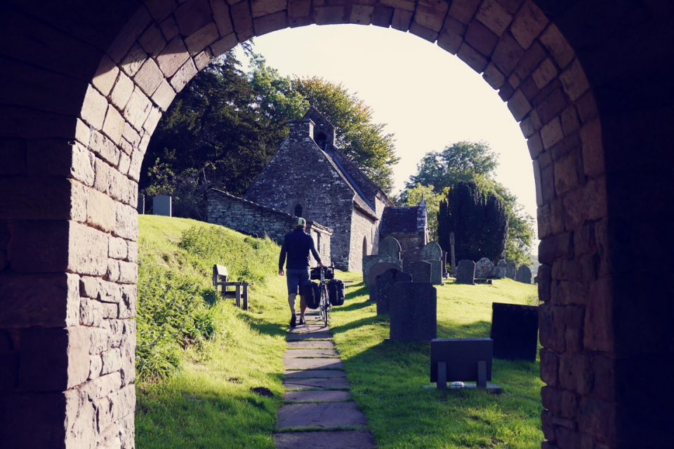
We awoke to clear skies the following morning and struck camp early doors. As a father to young children, Jack needed to be back home before 07.00am and I was keen to get on the road; the earlier I set off, the more I could enjoy the riding up through the Vale of Ewyas and onwards beyond Hay-on-Wye. It was too early for breakfast so Jack set me the challenge of reaching the Church of St Ishow in Patrishow – a short detour which features in the book. It didn’t look too far away but, looking at the contours on the OS map, it seemed I would definitely earn my porridge/blueberry breakfast and coffee. Deal.
In stark contrast to the moody Blorenge moorland the previous evening, the early morning Black Mountain sun shone over the rich rolling hills, sparkling through the gaps in the hedgerow as I rode along, past Llanbedr, through the less-travelled Grwyne Fechan – “the loveliest little valley in the Black Mountains” – eager to reach Patrishow.
The church and its setting was idyllic – a fantastic spot to fire up the stove for breakfast overlooking the lush Grwyne Fawr valley – not a soul for miles it seemed. The posters within the 15th Century porch at the entrance to the graveyard and small medieval church suggested the community was gearing up for a big Harvest Festival in a couple of week’s time. I wondered how many people were regulars at this remote church? Jack mentioned that I had to have a look inside – in particular at the rood screen used to shield certain ceremonial parts of the services from the masses. The font was dated 1055 which showed how old and significant this building really was. Of equal importance was the associated Well of St Ishow (a 6th Century hermit) down by the stream below the church. According to legend, he lived there and baptised people with the water – pilgrims through the middle ages used to travel there to be baptised. This continued until fairly recently, apparently.
This detour to St. Ishows church summed up what the Lost Lanes book, and travelling by bike, is all about – being prepared to take alternative (longer) routes to discover gems off the beaten track and delve into the culture of the places we ride through. Jack does a great job of highlighting these gems to look out for, to the extent that I re-traced my tracks in all the regions I have toured through to see what he had discovered…

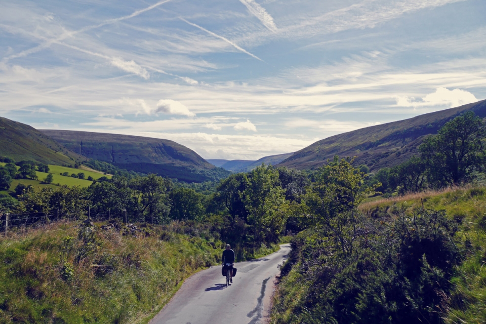
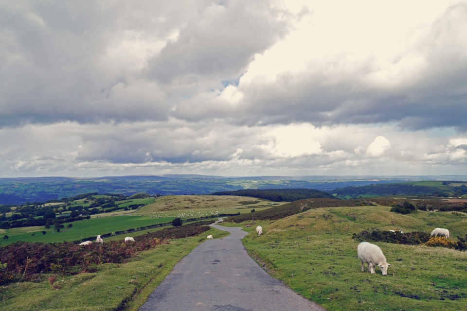
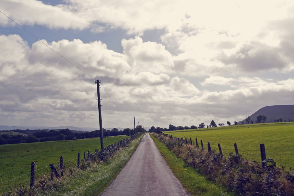
By 09.00am, activity along the lanes had picked up: farming folk were herding cattle; small groups of walkers were heading for Offa’s Dyke Path; and the hedge surgeons were hard at work. A sharp right turn (north) and I was on the old road to Hay-on-Wye and what was set to be the best section of riding of the tour: following the steep sided and secluded Vale of Ewyas up past Llanthony Priory and Capel-y-ffin church, over Gospel Pass – the highest paved road in Wales (456m), before descending down past Hay Bluff into the market town on the border with England.
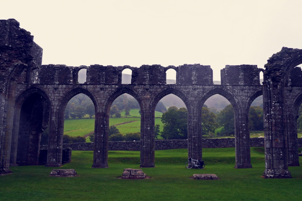
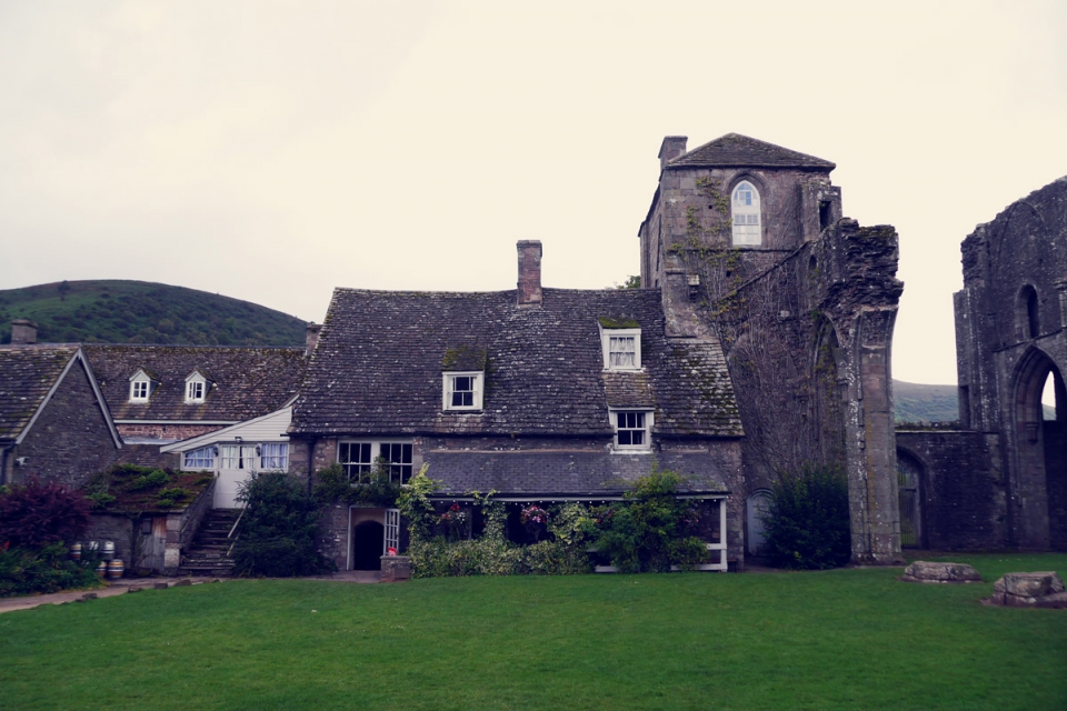

The route really was a joy, sharing the valley bottom with the river Honddu I could have taken 100s more photos of special lanes and places; every twist and turn drew me along, no matter the incline. Llanthony Priory was one of these places – an old Augustinian monastery set against the Hatterrall Ridge backdrop – that has been left to ruin since their dissolution by Henry VIII. A stop here was timed perfectly as not only had the rain closed in and created a moody atmosphere but the awesome cellar pub / café had opened. It was a tad early for a beer but I was glad for that because I discovered their addictive mugs of hot chocolate – perfect for walking around the impressive Grade I listed ruins with. Welsh cakes were an obligatory touring snack too, of course.
Interested in the Welsh language himself, Jack also makes sure to point out and explain the meaning behind the place names along the routes, and includes a selected Welsh Toponomy to help encourage the noticing of things from the saddle. For example, “Llan” – church/monastery – suggests “Llanbedr” on the OS map might have an interesting religious building or ruin to check out. It actually translates as “the church/enclosure of St. Peter”.
“Many Welsh place names help to do the work of maps by giving cues for wayfaring. For example, 'myndd' means mountain and 'bach' means little, so if your route takes in the village of Myndd Bach you’re in for a bit of climbing”…
Once passed the picturesque church at Capel-y-ffin, the hedgerows lowered and views widened across the valley to the Black Hill ridge-line (running between Hatterall Hill and Hay Bluff), which forms the border between England and Wales. As the exposed slither of tarmac worked its way up to its record 456m highpoint, quietly roaming sheep began to share the road and wild horses neighed around me in the strong cross winds.
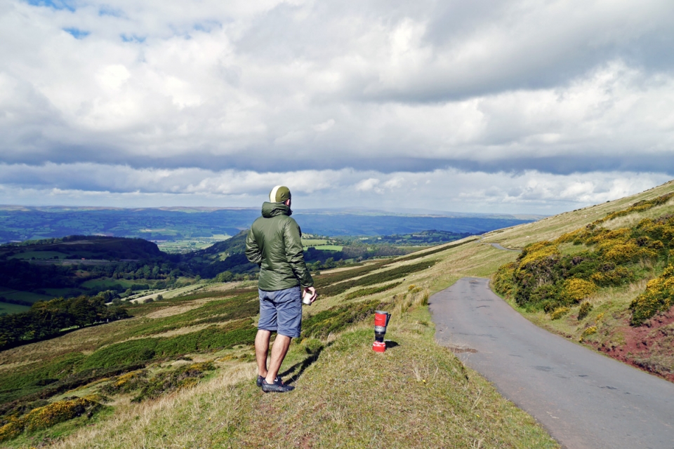
Upon cresting Gospel Pass, I was rewarded with views over Radnorshire and the Wye Valley for miles. With the long Alpine-esque descent into Hay-on-Wye ahead, I paused below Hay Bluff to brew a tea and spend some time in this most stunning of outdoor theatres.
Lost Lane |l?st le?n|
noun
1. A quiet single-track touring road; perfect for travelling cyclists.
2. A stunning and peaceful (yet often relentless) touring road that takes you to magical places; forcing brew-stops and every other attempt not to leave.
3. An escape road.
Stefan: “In the book you mention that 60% of Welsh roads are narrow, unclassified rural roads. Do you have a definition for what a Lost Lane is? Was there a cut-off point?”
Jack: “There is no fixed definition but a good place to start is with the roads that are marked on the Ordnance Survey Landranger maps as narrow yellow lines. These are unclassified roads of less than 4 metres in width. They’re roads that when two cars meet, one has to back up into a passing space. They’re roads that drivers avoid, so they’re perfect for cycling. They’re quieter, the hedges are more overgrown, they wiggle their way across the landscape rather than always following the valley floor or going in long, tedious straight lines. Wales is a hilly country and these lanes are often quite hilly, which can be off-putting but it just means you need to recalibrate your idea of what kind of distance is feasible for a day’s riding. Once you’ve realised that 40km in Wales can be the same effort as 80km in the south east of England, you can adjust your sense of distance…
…There was a time, probably fifty years ago and more, when all roads were great roads for pleasurable cycling. Then the main roads became too fast and busy with motor vehicles so cyclists took to the B-road network; this was the bread and butter of cycle touring in the 70s and 80s. These days B-roads can be pretty hostile. They’ve been widened and straightened, centre lines added and the relentless increase in traffic means they’re not very peaceful at all. Drivers expect to drive at 50 or 60 mph and the roads aren’t wide enough to provide safe space for cycling, and I don’t much like being passed at 50 mph even if I’m given three feet of overtaking space…
…So this was really the thinking behind Lost Lanes, to find routes that followed quieter lanes that are now the most enjoyable roads to ride. A Lost Lane is a road you can ride without feeling like you’re under siege from other traffic, where you’re free to experience the pleasures of exploring the countryside by bike as people have done since the bicycle was first invented.”
____________
Stefan: “You focus a lot on everything around the riding – the “pubs & pit stops”, the history, culture, language, local food and events – as a travelling cyclist that is just as important as the riding itself, right? Immersing yourself in the places you travel through…”
Jack: “I don’t ride a bike just for the sake of riding a bike. If I did that I may as well go to the gym and ride a static trainer. I ride a bike because it’s the form of travel that I find most immersive as an experience, and it’s easier to travel a good distance on a bike than it is by walking or swimming. When I travel I don’t just want to look at the landscape going by, I want to stop and meet people, find out something about the history, the gastronomy and the local traditions, get off the bike and explore interesting places. That’s my kind of riding, and it’s why I’ve never really taken to more organised forms of cycling, whether sportives or audax events, where there’s always this feeling of needing to push on, there’s always a reason not to stop. I’m more interested in the reasons to stop.”


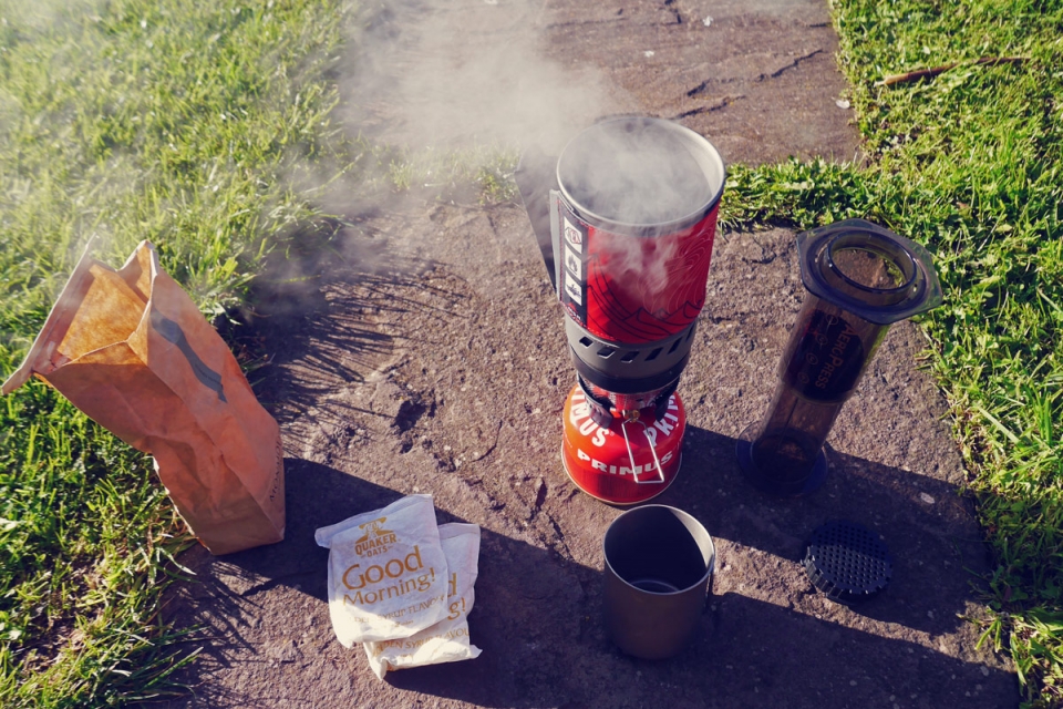
Hay on Wye was a charming market town and it is clear why these routes fall into Jack’s “Best for…” Weekends Away and Gourmets categories. Famous for its second hand bookshops and the annual Literary Festival, Hay is a bustling little town to explore – I was fortunate enough to be there for one of the regular food markets in the clock tower square so grabbed a bite and some extra ingredients for my camp-stove meal that evening before heading on to complete the northern-most section of the route around to Painscastle and Rhulen. I bivvied out, wild, just north of Hay and cooked up a storm on the camp stove(s): gnocci with Hay-on-Wye fennel sausage, passata and loads of parsley.
The following morning was about riding the return leg to Abergavenny from Hay for an early afternoon train back home – through England for most of the way, following a lane running parallel to Gospel Pass on the other side of the border ridge. Climbing out of Hay was as challenging as I expected given the descent from Gospel Pass the day before. However, this logic also meant that once at the high point above Craswall, it would be a long descent through the Monnow valley, via Longtown and its castle, through real farming country to the foot of The Skirrid. The last stage of the tour was the short climb up and around the western flank of Abergavenny’s Holy sandstone ridge – which offered views over the town and the Wye valley countryside.
As I passed the River Gavenny sign over the bridge on the way up to the train station, after 48 hours of analysing Welsh place names this one was easy: Aber-gavenny – the ‘Mouth’ of the ‘Gavenny’…
Stefan: “Any plans for a next (third) Lost Lanes book?”
Jack: “The first Lost Lanes book on rides around London and Southern England proved very popular. People really got behind the book, and I think this reflects the fact that London is leading the way in cycling in Britain, albeit from a very low starting point, and that London cyclists really took to the idea of hopping on a train out of the city for a day’s riding in the countryside. Wales and the Borders has a much lower population than Southern England and fewer people cycle here, so it’s been much harder to promote the book, even though I actually think it’s a better book than the first one, and certainly the landscape is more spectacular! So we’ll see how it goes. I’m hoping that people, whether they live here, or not, will use the book as the basis for longer explorations than day rides maybe stringing a few routes in the book together into a mini tour, just like you’ve done, or using the book as inspiration for improvising around my routes, and coming up with their own…
…If it goes OK then the next on the list is South West England. I really do hope that I get to do it as I love that part of the country, have many relatives down there and often rode my bike to visit them. So it’ll be a great to revisit favourite places as well as discovering new ones.”
__________
Lost Lanes Wales | Book Information & Shop
__________
NOTES.
I actually did the route in the reverse direction to the book in order to meet Jack the night before and fit the tour into the time I had available.
When Jack grades a route as ‘challenging’ it really is challenging: gradient and climbing wise, not distance.
Abergavenny train station is on the Newport – Hereford – Birmingham/Crewe/Chester lines. One change from London, the South and South-West lines.
OS Landranger (1:50,000) Maps 161 & 148 cover this route.