Josh’s newly founded touring group of five opted for a slightly longer route that traversed the country in three clear sections: Dushanbe-Khorog, Khorog-Langar, Langar-Kyrgyzstan. These days in the saddle made for some of the most unforgettable riding of his entire Eurasian journey…
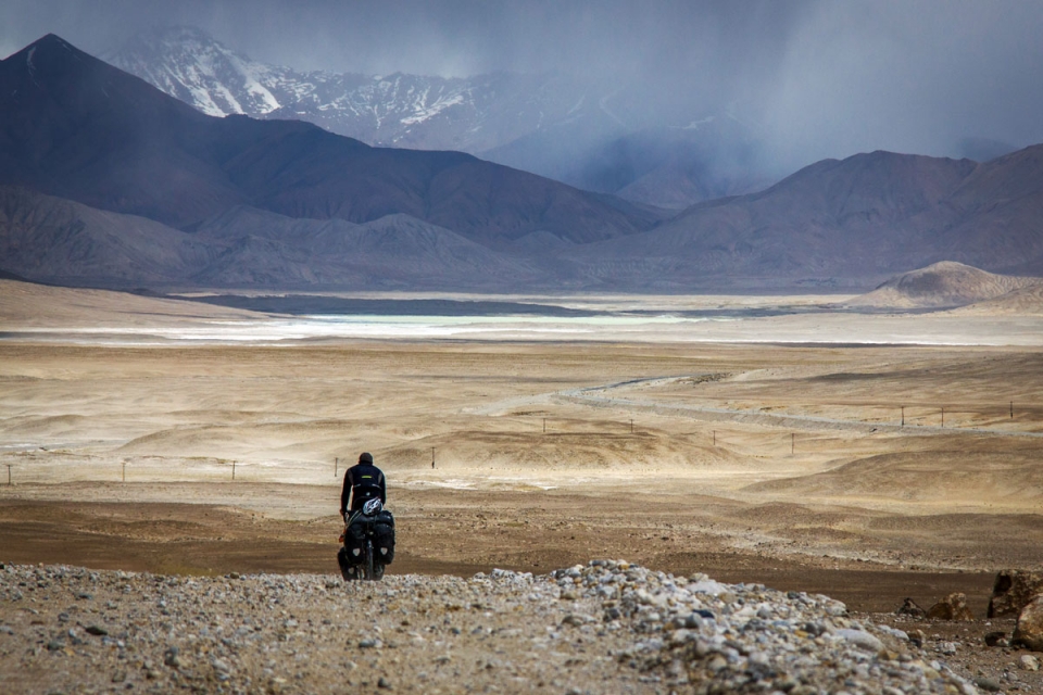
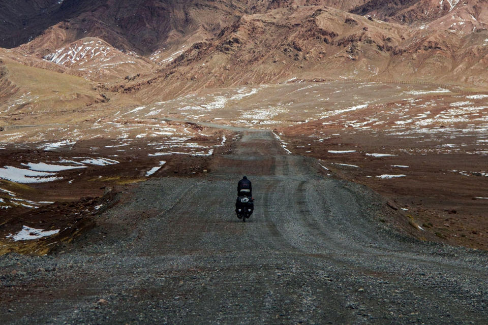
I look down at my speedometer and squint broken-heartedly at our speed. My patience is tested once more, but 3 kph is a speed that must be accepted at these 4000m+ altitudes. My eyes are then drawn wearily to the ground below – a punishing mixture of sand and rock, with the fresh tyre tracks of my companions weaving through like those of a drunk on a bicycle. For a few minutes this rhythmic passing of time is consuming enough to allow me to forget about the summit for a while – a summit, which at 4344m will be the highest of the journey so far. But progress, heavily impeded by the road surface, gradient and altitude, remains pitiful. A glance at my watch reveals the time to be 4pm, and despite the sun having long begun its descent towards the jagged silhouettes that form the horizon ahead, it feels as if there’s a long way to go before we can consider calling it a day…
My month in Tajikistan had begun by leaving my companion Rob behind in the deserts of Uzbekistan while I raced ahead to apply for an Indian visa (which would later be rejected) in the capital of Dushanbe. I arrived at the famous Vero’s, a WarmShowers host where almost all Pamir Highway-bound cyclists stay, and was received by groups of ones and twos camping in the garden who had just completed the infamous stretch. Their faces, bikes, and stories said it all My excitement for the road ahead increased to fever pitch, whilst a seed of doubt had been planted in my previously unshakeable mindset: this could potentially be quite difficult…
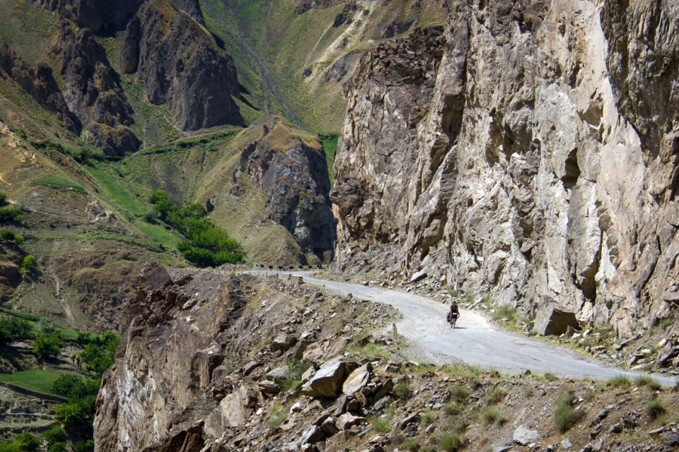
The Khargush Pass is effectively the southern route up onto the Pamir plateau, from the road stops at the head of the Wakhan Valley, to where it materialises again 120km later in the form of the M41 – which most people know as the formidable Pamir Highway. It was the single most remote section of my route, which took three days to cross. and also meant the worst roads, the best views, and the most unforgettable riding of the entire trip.
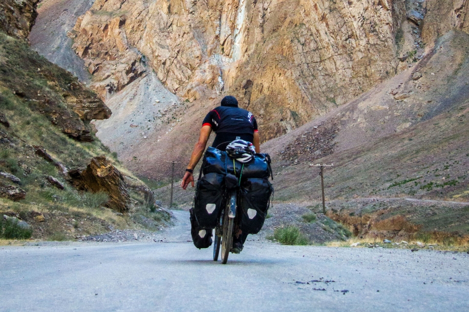
"The majority of riding was again on gravel roads ... We were a group of five, but in such environments it is impossible to stay together: different riding speeds; enthusiasms; energy levels; perspectives on photo opportunism; bowel movements."
Once the Indian embassy had told me to apply in my home country for my visa (which I had wanted to obtain before applying for my Pakistani visa due to the tensions between the countries, and the likelihood of being rejected for an Indian visa if already holding a Pakistani one) we were eventually on our way. Rob and I, companions for almost 4 months now, had been joined by Pete (a friend from home, who was set to accompany me until Bangkok), Dave, and Jonny (two others we met at Vero’s who were looking for company as they headed east) – we were now a touring group of five…
We had chosen en masse to opt for the longer route, which would take us through Tajikistan in three clear sections:
1] Dushanbe-Khorog
2] Khorog-Langar
3] Langar-Kyrgyzstan
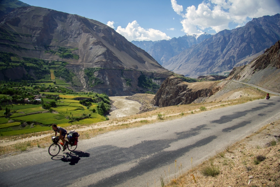
First, from Dushanbe, was over a smaller sub-Pamiri range, which dropped us down onto the Afghan border and the banks of the Amu-Darya river – formerly the historically famous Oxus – to Khorog: seven days of riding through mountain pastures, savouring their sole month of colour between the toneless winter and summer periods, and enjoying a total lack of well-surfaced roads in equal measure. After spending a couple of days recuperating and fixing our bikes in Khorog, we embarked upon section two, which took us a little over a week. The majority of riding was again on gravel roads, interspersed
with portions of tarmac and unrideable fields of rock and boulder. In such environments it is impossible to stay together as a group: people have different riding speeds; enthusiasms; energy levels; perspectives on photo opportunism; bowel movements. Yes, unfortunately, for all of us, keeping things together in the nether regions was a constant problem throughout Tajikistan. As long as the regional culinary and hygiene habits remain, I’m sure we won’t be the last.
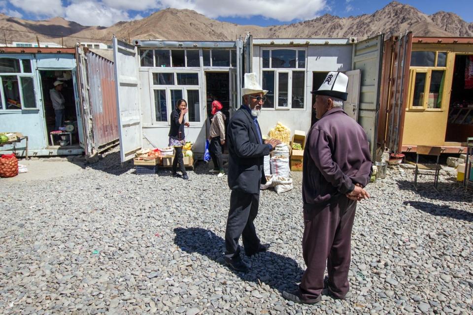
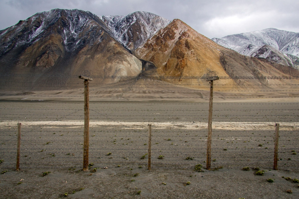
We made our way east at our varying speeds, along the Wakhan Valley, through intermittent villages populated largely by agricultural families, either working meagre fields of crop, picking berries, or shepherding flocks of goats up through gullies in the surrounding cliffs to higher pastures. Unemployed young men congregated in long-abandoned village bus shelters, kicking empty bottles around and looking despondent. Indeed, many of those who welcomed us into their houses or engaged in conversation at the roadside had family members working in Russia who sent money back home to these desperately poor mountain communities. Reports also came through that across the river in Afghanistan, Taliban groups had overcome villages just 20km from the border in regions that were ethnically the same as ‘our’ side of the river, and where many Tajiks had relatives.
So sadly, despite the overwhelming beauty of the place in every direction, it was not difficult to see that the region is also stricken by a myriad of problems concerning its future.


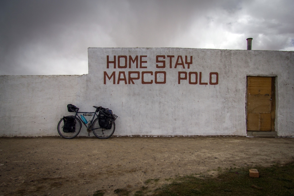
"...it was snowing, so we lingered for most of the day in a small house – ‘Home Stay Marco Polo'. The elderly couple had become wise to this being a popular route for travelling cyclists - every pot of tea was followed by the swift brewing of another"
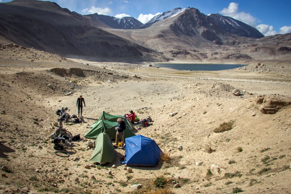
At the head of the valley lay the village of Langar, where we spent a final night camping at the relative warmth of 2000m, before spending two hours trying to locate the shop in the morning to stock up on the group’s chosen appetite suppressants of instant noodles and cigarettes. When we eventually found it, and the owner, it turned out to be the now-familiar set up of somebody’s front room, with some items for sale scattered around.
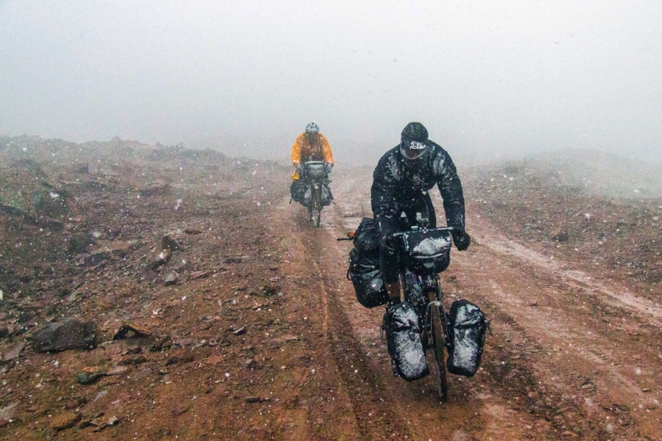
The next few days were an uphill struggle, literally, until we reached the summit of this piece’s opening anecdote on the Khargush Pass. At which point it started snowing, and became somewhat of a downhill struggle: we had lost Dave, Jonny had disappeared up the road a few hours previously, and Pete was suffering from perpetual pannier breakages on account of the roads, which left us sprawled across the mountain in a bedraggled mess. The snow fell hard, whipping through our spokes, over our frozen brake-clutching fingers, and between the slender gap left in our balaclavas to see. Waiting to regroup meant stopping, and stopping meant getting extremely cold extremely quickly at over 4000m, so we battled on in our own little worlds of discomfort, bouncing in and out of the company of each other following whichever snow-clouded silhouette that happened to be in front.
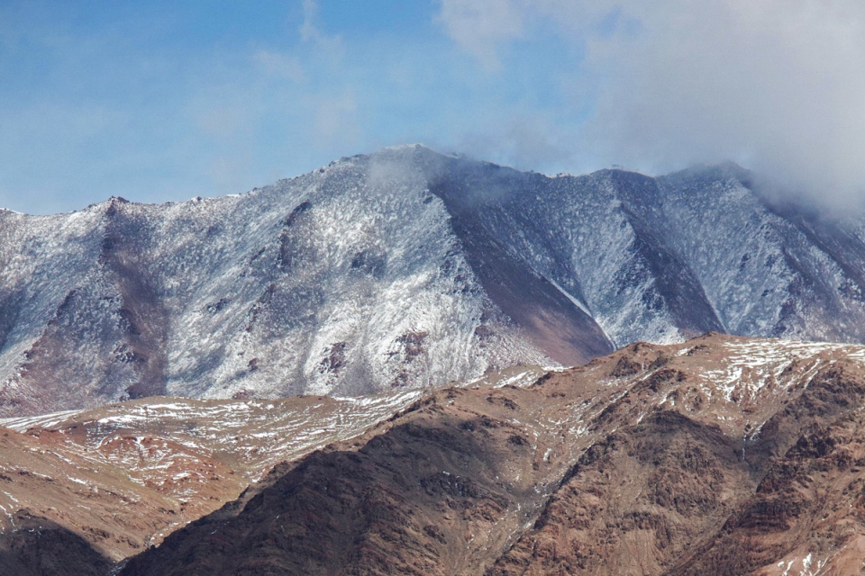
Once we had descended far enough the skies cleared as quickly as they had darkened, and from our still-lofty heights we were rewarded with our first view of the Pamir Plateau: a mind-bendingly huge expanse of deserted plains and brown shallow mountains, wrapping around each other below a
twisted sky – whose various identifiable micro-weather systems moved quickly across – casting light and shadow, bringing colour and life to this place of otherwise desolation.
We eventually arrived at the small village of Alichur, famous among cycle tourists for being either the point of refuge, or cast-off if coming in the other direction, before or after tackling the Khargush road to Langar, or the main Pamir Highway stretch to Khorog. Again it was snowing, so we lingered for most of the day in a small house – ‘Home Stay Marco Polo’. The elderly couple had become wise to this being a popular route for travelling cyclists – every pot of tea was followed by the swift brewing of another. Stale biscuits and thick slabs of butter were dunked into a bowl of sugar and gulped down by the dozen, as we took turns to sit by the shrub-fuelled stove and nip out to the adjoining ‘shop’ to restock our supplies of fake Snickers bars and pasta bows.
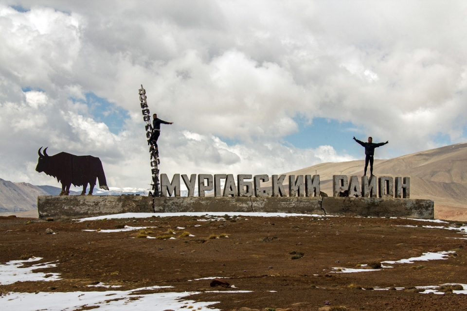
The end of Rob’s journey came prematurely when the pawl springs in his freehub became stuck. Without the appropriate tools to repair it he was left with no drive engagement, and was forced to abandon the final ride north into Kyrgyzstan. He did however manage to borrow a bike in the former Soviet military base of Murghab, ride it the 80km to customs at the closed-to-foreigners Qolma border crossing, and complete his aim of riding from Stockholm to China. Jonny was suffering from all sorts of stomach ailments too, which hindered his progress, and so Pete and I completed the final few hundred kilometres of our Pamiri adventure, from Murghab to the Kyrgyz frontier village of Sary-Tash, by ourselves.
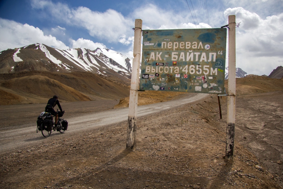
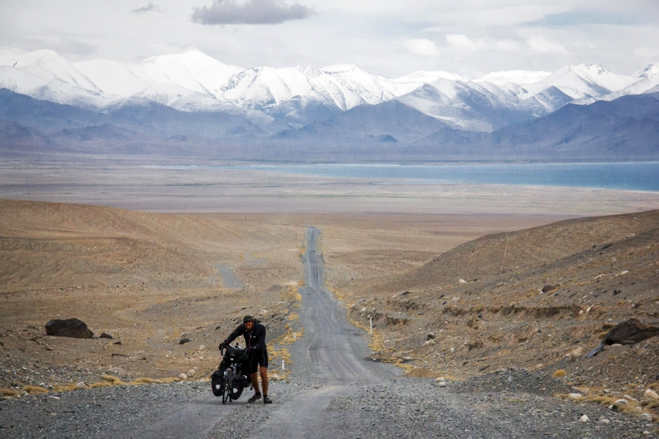
Our route took us over the Pamir Highway’s highest point, the 4655m Ak-Baital Pass, and along the banks of the irresistibly blue Karakol Lake. As a side note, there are a few namesakes of Karakol in the area, both in Kyrgyzstan and China as well as Tajikistan. It’s a Turkish word meaning ‘black lake’, and despite not living up to its reputation under the blue skies of the springtime northern Pamirs, it’s nonetheless a reminder of the Turkic heritage shared across Central Asia.
Coming after a harsh couple of days, the village of Karakol on the eastern shore of the lake provided another lengthy afternoon tea stop and snooze, but with our Tajik Somoni (currency) running out we just about managed to reject the inviting warm lure of its floor for the night and continued on to spend our final night at the top of the fifth (of six) 4000m passes comprising the traditional Pamir Highway route.
The breaking of a new dawn also brought with it the breaking of the clouds, and so it was through a snow storm befitting of the previous few days that we made our final ascent, past an equally befitting Soviet-style monument-cum-welcome sign, up to the bleak, barren, high altitude wastes of the Kyrgyzstan border.
The descent would carry us into a totally different world…