The Massif Central region of France stretches from the centre of France, south down to the Mediterranean, and covers some 93,000 square km of mountain, high plateaux, forest and heathland. As part of a longer tour, Chris rode the Grand Traversee du Massif Central (GTMC) trail, before heading into Spain…
After a few years of mountain biking, I was looking for a trip that didn’t involve throwing myself down rocky tracks that I wouldn’t even try to walk down. Perusing the web, I unearthed a whole community of people travelling long distances on backroads, dirt roads and tracks by bike, some just for a few days, others travelling the length of continents. This was not how I had previously pictured cycle touring, and it sparked my imagination.
Since, I’ve been trying to incorporate trips of these kind – long weekends in the UK and some bigger trips riding to Switzerland and across northern Spain, with as much off-road content as possible. I’ve tried to learn to pack lighter, using new bikepacking gear to save weight and limit space. This year it was time for a bigger trip, off-road across all of France and Spain for a few months, trying to use long distance walkers’ paths and mountain bike routes. After picking my way down through to the centre of France, I was at the start of the GTMC, the first of the long distance mountain bike routes…
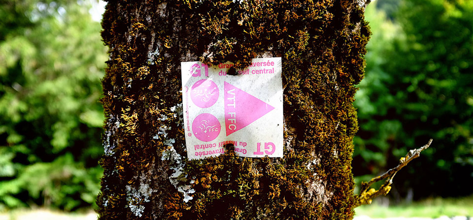
The Grand Traversée du Massif Central (GTMC) mountain bike route crosses this region, running for 718 km from Clermont Ferrand in the north, to Sète, just south of Montpellier on the Mediterranean Sea. This was the first long distance mountain bike route to be completed in France. Along its length, it climbs around 12,000m and descends a little bit more over tarmac, dirt, gravel, rock, sand and mud, depending on the weather!


After two days of rest and hot weather, thunder echoed around the hills the night before my departure from Clermont Ferrand. The following morning, I packed up my wet tent and pedalled off eastwards to pick up the GTMC trail at Laschamps.
The first kilometers down to Murol were slow and hard going – the trails were in poor condition given the wet weather – which meant pushing the bike along slippery, mud-clogged sections of forest. Varying trail conditions make every ride, and tour unique. Thankfully, things began to dry out over the next few days, and the improved weather allowed the unfolding landscape of the Massif Central to shine.
For the next few days, there was plenty of descending as the trail left Auvergne plateau before passing through the villages of the Margeride – a remote area that was used as a base for
the French resistance during the Second World War.
I spent a couple of nights as the only guest in some small gîte d’etapes. The gîte menus were simple with just one choice: a starter of some kind – perhaps a local meat terrine, or a fresh salad; a meat based dish – chicken with lentils, or cheek of beef (as at the family run gîte in Le Giraldes, from their own rare breed cattle); cheese; and then a dessert. Wonderful.
One night, I shared a gîte with three French women who would normally accompany their husbands on walking holidays but wanted slightly less climbing than they are usually subjected to. They chatted around the table with our host Marie. I struggled to keep up with the conversation but they occasionally gave me a little recap in English, and it was a welcome change to share dinner with others, after a few weeks of eating by myself in camp, or being the only guest.
"Varying trail conditions make every ride, and tour unique"


The trail leaving Bagnols les Bains (913m) headed up and over the Mont Lozere massif, passing La Croix de Maitre Vidal (1445m) and the Col de Finiels (1541m). I was now heading into the Cévennes National Park, which astonishingly contains around 50% of France’s plant and animal species, in an area that only occupies 0.5% of its landmass.
Descending the other side of the Massif, I found the little village of Pont de Montvert which sits close to the source of the Tarn river. The village has a violent history, being the place where the War of the Camisards, between French Catholics and Protestants, broke out in 1702. It is also well known for Robert Louis Stevenson’s Travels with a Donkey in the Cévennes (1879) – an account of his journey through the Cévennes mountains and one of the first books to present hiking and camping as recreational activities.
At a campsite on the edge of the Tarn I found a great spot for a swim and some of the first people travelling by bike I had encountered so far. Lien and Detlef from Belgium were on a year long trip heading to Spain, looking for some work on organic farms in order to learn and develop plans for living more sustainably.
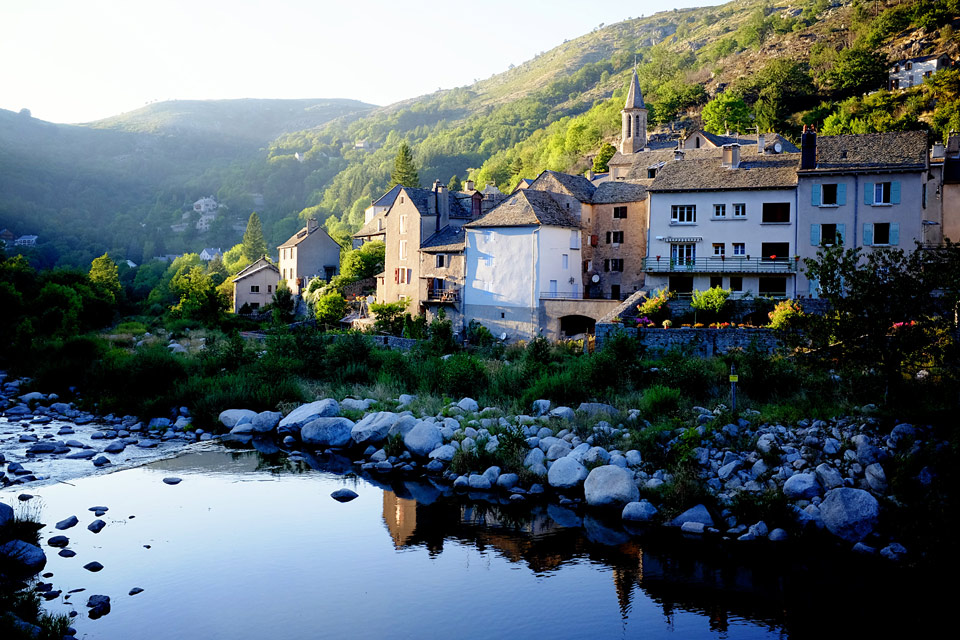
I headed on, up the Stevenson trail before following the Tarn valley via Florac to St Enimie, partly through the woods and then partly on the road to avoid some really rough sections of trail.
Both Florac and St Enimie were gorgeous little towns, and I spent the night camped right on the river, just outside St Enimie. The Tarn is a popular place, and the locals know how to find the best spots.


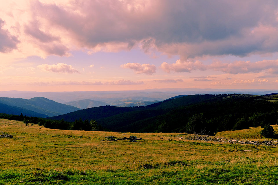
The following few days involved climbing in and out of river gorges and crossing the Causses limestone plateaux, where the land was empty and less forested. The climb up to the Col de Perjuret was particularly memorable for a long period pushing the bike, but eventually I ground my way up to the top of Mont Aigoual (1507m) where some walkers had promised me I would find a water fountain to refill my empty bottles. The climb seemed to take forever, constantly having to stop to munch on nuts and chocolate, but the scenes at the top were worth it.
I found the water fountain but after spending time searching for an overnight refuge that was supposed to exist, found nothing open. Disappointed that I wouldn’t be at the top of the mountain at dawn, I considered hiding in the woods overnight but camping in the area was strictly forbidden. I ended up riding down a gorgeous winding road for half an hour to find a little campsite in the woods on either side of a bubbling stream, just outside Camprieu.
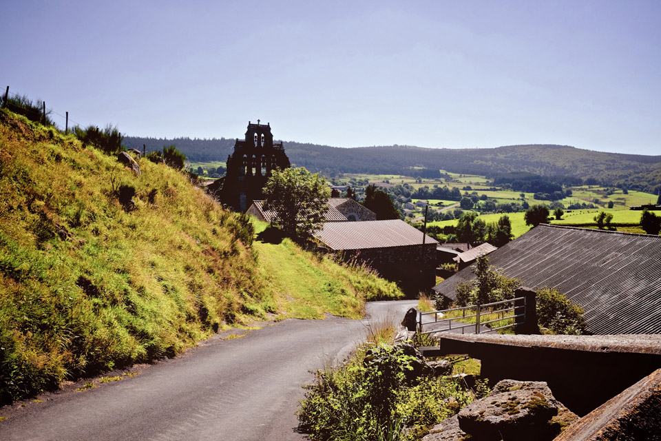
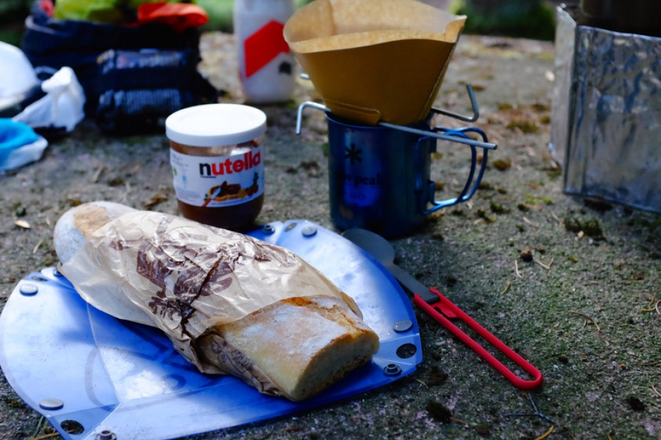
The next morning I prepared the breakfast of champions: fresh(ish) bread, Nutella and coffee. The skies looked ominous, but I knew I had been spoilt with good weather for the past couple of weeks. Leaving Dourbies, I heard thunder rolling around in the valleys chasing me, but managed to make it to the walled town of La Couvertoirade without a drenching.
La Couvertoirade was founded in the 12th and 13th Centuries by the Knights Templar and is now mostly inhabited by artists making work for the masses of tourists. I stayed in the Gîte de la Cite, housed in the former rectory in the shelter of the town ramparts, squeezed in amongst a large group of French friends here to walk, and a couple of mountain bikers riding the GTMC a little quicker than me – on full suspension bikes with just a few clothes in a rucksack.
I went in search of a cafe. As I pulled up and rested the bike, I felt what I thought were looks of disapproval from the elderly couples sat on the terrace, as they glanced at my bedraggled, hairy state. After my coffee and Coke, I went to put some air in my tyres when one lady turned to me and, with a tentative smile, asked where I was from and about my trip. They were a Belgian couple, sat with another couple from Bristol. The lady from Bristol gave my Surly Ogre the best compliment “I was just thinking it looked like a wonderful bike, but was wondering where are you going to put the baguette?” (I had to break a bit off the end and eat it to squeeze it into the frame bag…).
I often think that people are thinking the worst but actually, looks of disapproval are often looks of genuine curiosity which end up in lovely conversation.
“I was just thinking it looked like a wonderful bike, but was wondering where are you going to put the baguette?”


From La Couvertoirade I contemplated just heading on down to the coast, away from the hills and the rain, but I had only had one last day on the GTMC and the views were meant to be amazing, so I mustered up the motivation to leave and head into the hills. Perhaps as penance for even considering leaving the trail early, the heavens opened once again. At times I was riding through a river flowing down the tarmac, washing the gravel from the side of the road down with it.
I arrived in a misty, deserted La Vacquerie feeling subdued, and very wet. I opted to stay in the CAF (Club Alpin Francais) gîte, the door to which I discovered unlocked. I let myself in, sorted my soaking gear out to dry and cooked by myself before heading to the empty dorm room and dozing off as the wind battered the building and the trees in the square outside.
After the previous day’s soaking, I was not that enthusiastic about what was meant to be my last day on the GTMC before peeling off southwestwards towards Spain. At the same time, I really wanted to ride the trail because it sounded very different to the rest of the route. So, after picking up some lunch (fresh bread and tinned pate) from the village epicerie, I pedalled off.
I took the road up Mont St Baudille because I couldn’t actually find the trail. The road itself wasn’t long or steep but climbed up into the clouds, so the amazing panoramic views that I was promised did not materialise. The trail then headed
northeastwards along the ridge, disappearing through the mist. It was quite eery, I really couldn’t see more than 20 metres in any direction, until I descended the valley edge and dropped below the cloud again. This section felt the remotest of the riding so far. The forest was everywhere, and the yellow trail could be seen snaking through it, off into the distance. At times the trail was relatively smooth but there were also large rocky sections where I had a couple of hairy moments trying to stay in control, and had to remind myself of how long a walk it would be if I gashed my tyre badly, or injured myself.
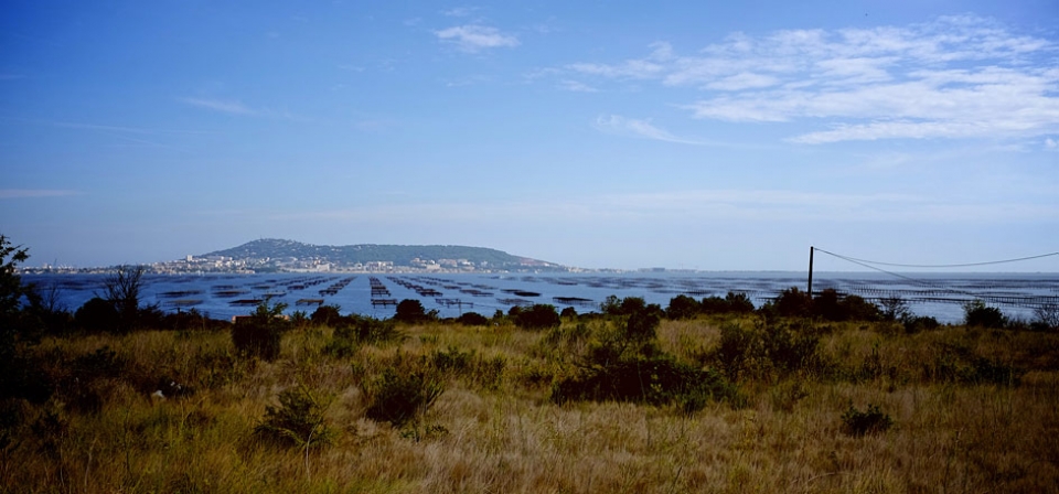
Eventually, I turned a corner and could see the flat coastal plains beyond the mountains. I was heading down, out of the Massif Central for the last time. I was so glad that I had ridden this last day of the trail. It had been challenging but really enjoyable, and the landscape and feeling of remoteness different to anything else I had experienced in the Massif Central.
I spent a couple of nights in St Guilhem le Desert – a lovely medieval village, sited either side of the Verdus stream in a steep sided valley, and built around an Abbey founded in 804 by William of Orange. There was another CAF gite here – again just €15 a night – above a little bakery called Croc’Eclair, run by the friendly Natalie who had a very trusting arrangement with a key that was hidden in a letterbox nearby.
"The trail then headed northeastwards along the ridge, disappearing through the mist...This section felt the remotest of the riding so far. The forest was everywhere, and the yellow trail could be seen snaking through it, off into the distance"


Looking back at the last two or three weeks, the whole route had been amazing, and incredibly varied, but I was grateful to have a day off the bike. It was the perfect place to rest, in between the hills of the Massif Central and what was ahead of me – the Mediterranean Coast, and the road to Spain…
Tips for Crossing the Massif Central by Bike
1. Go light, and take an off-road bike
This is most definitely an off-road bike route. Some of the trails involve lots of singletrack or rough, rocky ascents and climbs. There is a lot of climbing. The lighter you are, the more enjoyable the ride will be.
2. Take cash and don’t miss an opportunity to resupply
The GTMC passes through some quite remote areas (for Europe). Its not uncommon to come across only very small villages for a few days at a time, where you won’t find any cash machines, and any shops, campsites and hostels often won’t take credit/debit cards. So best load up your wallet with some notes when you have the opportunity in order to avoid big detours to find some cash.
3. Take a GPS, maps or guidebook
Whilst the trail is waymarked, the signs can’t be relied on to navigate on their own. In places they are missing, or faded to the point that you can’t see which way they point. In the Cevennes National park, the signs are not allowed at all.
4. Don’t be obsessive about only taking the ‘trail’
Some sections of trail might be impassable, or just plain unenjoyable, depending on the conditions (e.g. very muddy after periods of rain) and how much gear you have with you. Using a map, it is easy to identify backroads to avoid certain sections of trails if needed. Some of the route is on tarmac anyway, so its not cheating to make up parts of your route yourself, if thats what you feel like on the day – the scenery is still magnificent.
5. Be prepared for all weathers
Although the Massif Central can be very hot in the height of summer, in September I experienced driving rain, low temperatures, scorching heat, thunderstorms and both nights too warm and too cold for the sleeping bag I had with me. Be prepared for all sorts of conditions. Much of the trail is on high ground and very exposed to sun, wind and rain.
6. Plan to take your time and explore
If you are travelling light and prepared to get up early and ride long days, it’s possible do the route quickly. However, the area is beautiful, steeped in culture and history, and a lot of pleasure is to be had in being able to stop and take in the small towns and villages, and gorgeous landscapes. Take your time and enjoy this amazing but often overlooked area.