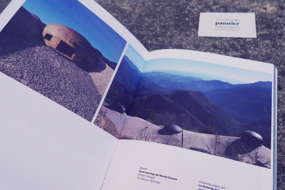
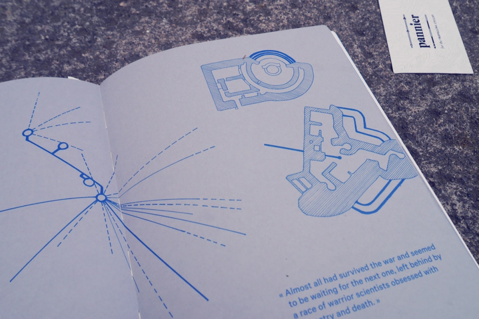
It’s official: Max Leonard has been unofficially crowned one of the most niche cycle tour guides ever. In the height of the Cote d’Azur summer, Max led us up into the Alpes-Maritimes mountains on a three-day bikepacking trip to explore the Little Maginot Line & Vallo Alpino Bunkers he had spent eight months documenting for a beautiful new book – Bunker Research – the hidden history of modernism in the mountains.
Reading through my copy of Bunker Research I was immediately inspired by Max’s narrative amidst Camille Macmillan’s stunning photography, eager to arrange a bikepacking trip to discover this increasingly hidden mountain infrastructure. Max was keen too; his Bunker obsession spawned from exploring the area by bike in the first place. Our aim would be to ride into the mountains in search of Bunkers, wild swim where possible, and enjoy camping out at some of the high Bunker sites, with some French pain, vin, and Boursin.
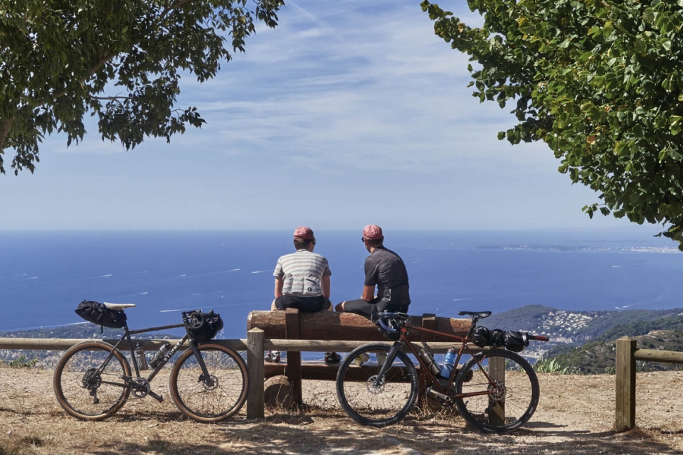
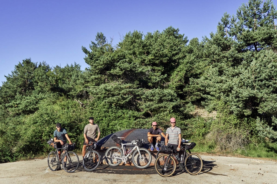
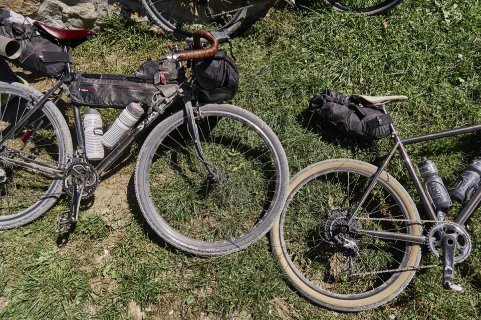
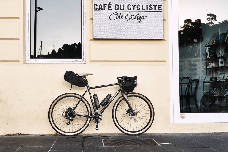
Tour Guide confirmed, we teamed up with photographer Antton, and Remi & Ali from Café du Cycliste (CdC) – connoisseurs of the roads & tracks of the Alpes-Maritimes – for a first-class base in Nice, and good company. Bunker bivvy kit packed, hip flasks filled, 40mm tyres fitted, bikes loaded; the five of us were ready to set off from the CdC café early one Friday morning…
Bunker / Ouvrage (french) [n.]
A military structure for defence or protection, that exists mainly underground.
Cloche [n.]
A domed cast iron fixture on Bunker tops, for observation or firing. There were various types depending on weaponry. Some were retractable.
________________________
Leading up to a trip, I always find myself visualising moments on the journey ahead, and looking through photographs of the Gros Ouvrage de Monte Grosso in the book aided my excitement for this Bunker Research trip no end. I had visions of us riding challenging gravel tracks up into the mountains totally alone, not even able to share our bottles of Bunker Bourgogne with other cyclists, however hard we tried. Where would we camp out at the Bunker sites? On the Bunkers? Inside the Bunkers? On the hillsides around the Bunkers? Much of that depended on the weather I guessed. Would it be weird to camp out at a Bunker site? I didn’t know; probably. The only given was that, in the Mercantour National Park, campfires would be a no-go.
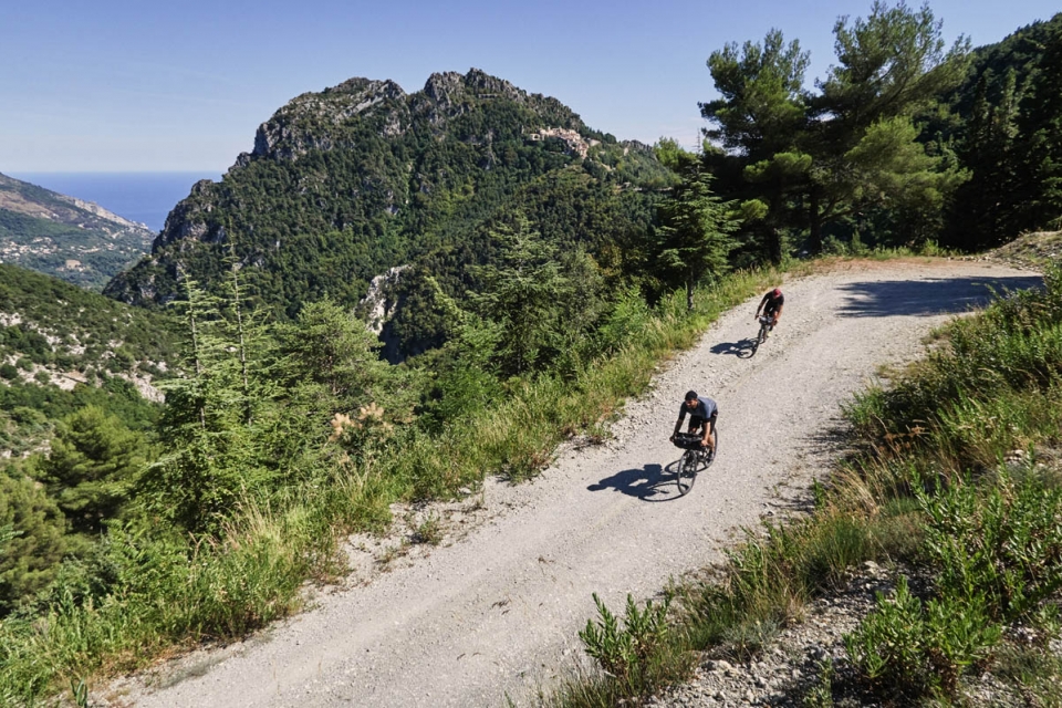
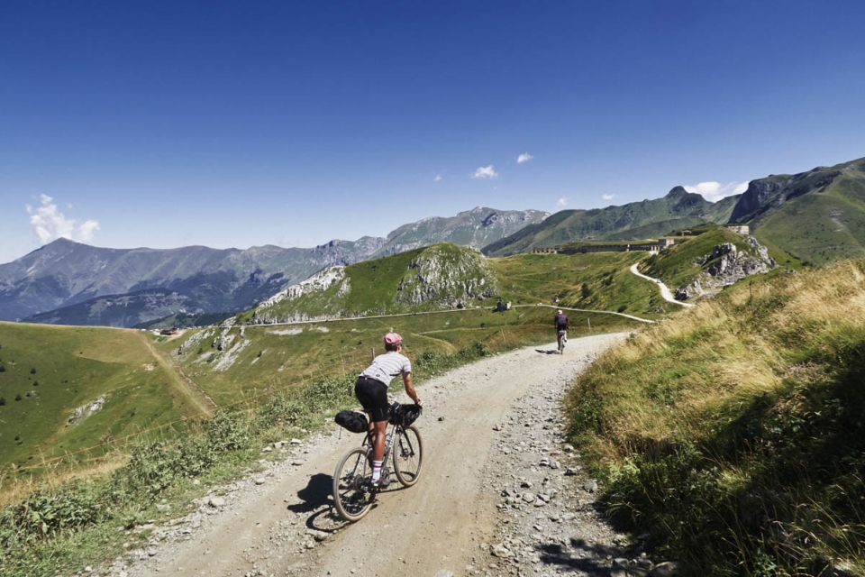
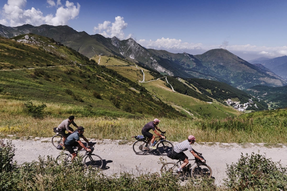
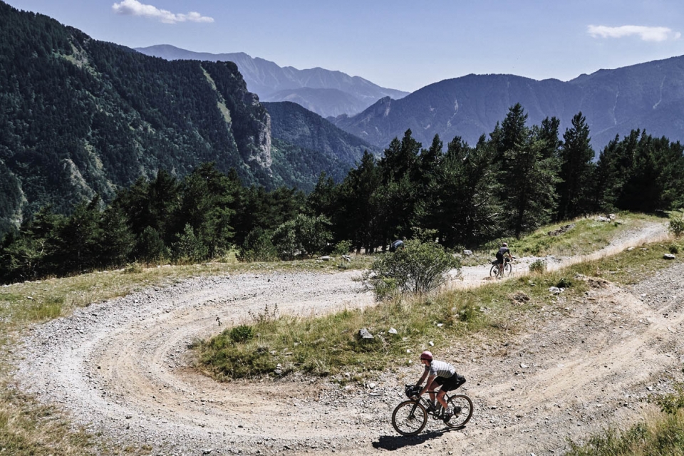
There were two really satisfying aspects to this trip from the outset. First – the route hadn’t been up to me. Usually I am the one obsessing over details but this time I had the freedom of riding into the unknown; unless I used the sun as a compass and could make out the Roya valley, I would be lost in the mountains for three days. Ideal. Second – this was to be everyone else’s first overnight bike trip, so Pannier had the chance to share our bike luggage & camping kit knowledge to ensure we were prepped for a few days on the road. We would be taking day rides that these guys were used to and turning them into a real adventure – attacking the mountains and carrying on without retreating; dropping from their speedy average speed to a Pannier Pace of around 15kmh…
"The 20th Century bunkers catch the eye and exercise the imagination … sitting in harmony and discord with the mountains around them” (BR)
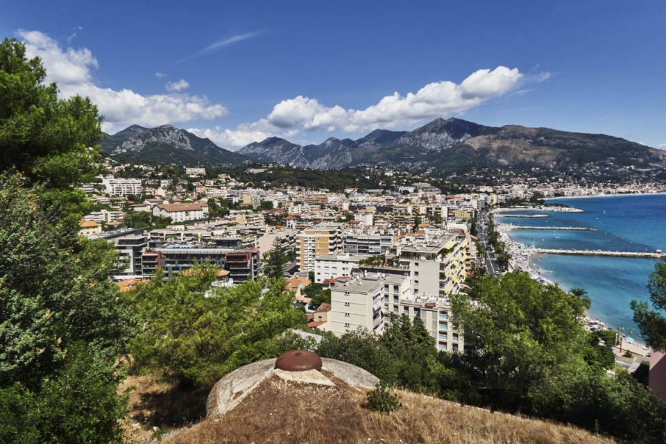
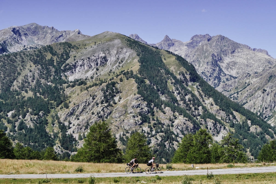
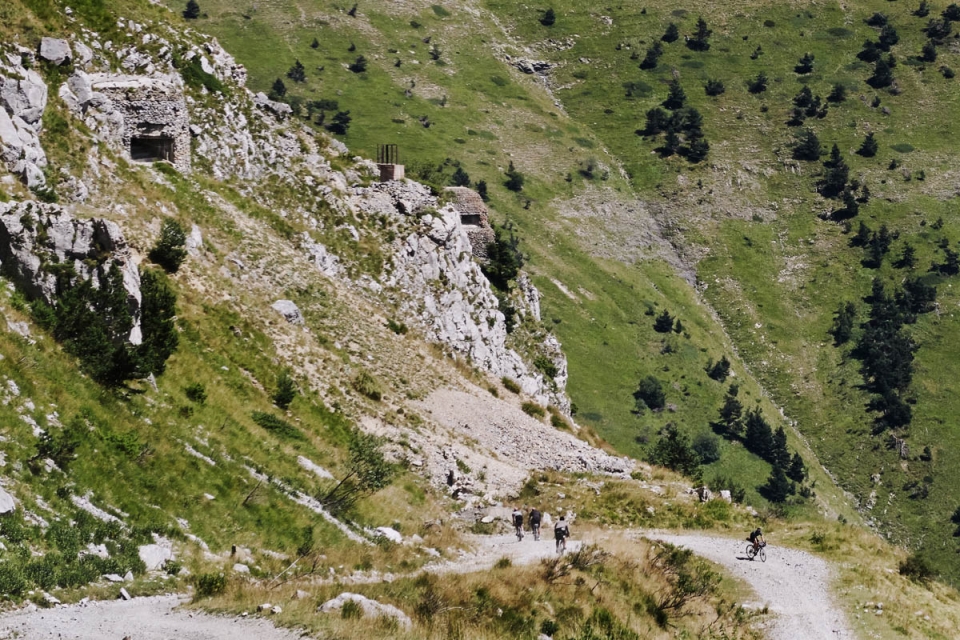
After sinking a flask’s worth of espressos and seatpack-load of chouquettes at the CdC café, we headed straight up into the hills behind the Port of Nice, climbing Mont Leuze and Mont Fourche to Col d’Eze, via our first gravel Route-Strategique (military roads built to access and supply strategic sites) of the trip. Nice as it was to earn the views over the Cote d’Azur, this section turned out to be a mere warmup as we soon descended past Monaco back to the coast and sea-level, to our first Bunker – the Gros Ouvrage de Cap Martin in Menton. Hidden below a roundabout overlooking the bustling seaside town, this Bunker housed 7 officers and 353 men and was the last bastion of the French Maginot Line : a line of fortifications built between WW1 and WW2 (named after War Minister Andre Maginot), to defend their borders from Belgium to this point on the Mediterranean coast.
The fortifications in the Alpes-Maritimes we were seeking on this trip formed the southern extension known as the ‘Little’ Maginot Line, built out of paranoia that Italy would invade France over the Alps – a challenging, but nevertheless
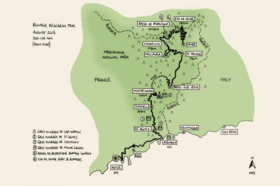
unprotected border – and take Nice, France’s jewel on the south coast. Of course, the Italians responded by building their own version – the Vallo Alpino (Alpine Wall) – under the direction of Mussolini to protect their 1851km borders with France, Switzerland, Austria and Yugoslavia. As a result, there is now a Bunker face-off between Italy and France at each of the weak points along the Alpes-Maritimes border. From the French perspective, three main river valleys needed defending: the Tinee and Vesubie to the north, and the most vulnerable – the Roya valley along the border. We would be riding up to visit some of these French and Italian Bunkers watching over the Roya, as north as the Col de Tende and as high as 2000m.
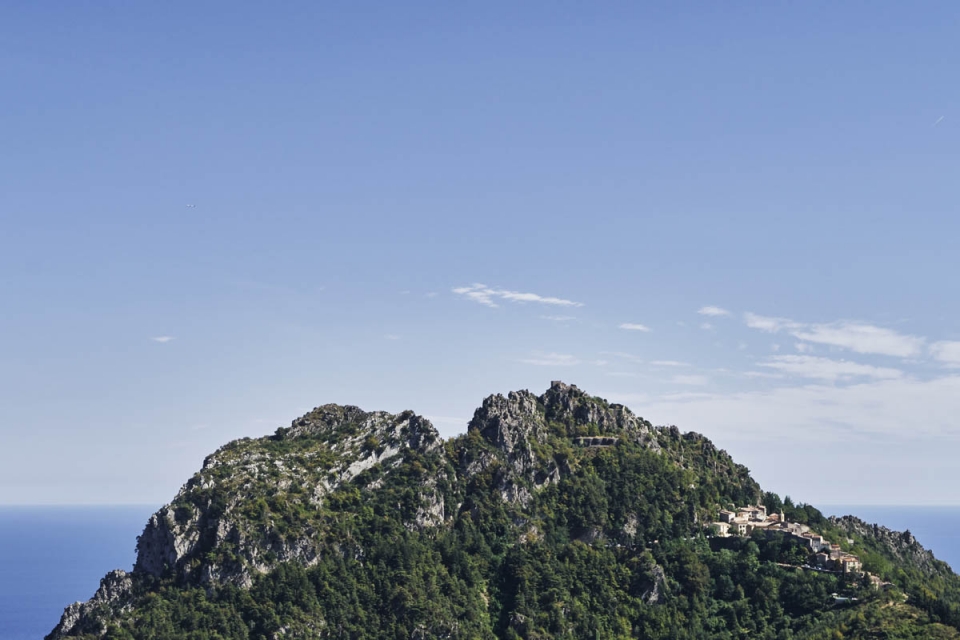
Following a cafe-stop in Menton, we took on one of CdC’s favourite climbs, the Col de Madone, to see our next mountain-side Bunker – the Gros Ouvrage de Sainte Agnes, disguised as a strata of rock in the peak over the picturesque town. Given the challenging access to some Bunker construction sites, often localised stone was used in the concrete aggregate, which provided an additional level of camouflage…
________________________
Avant-postes [n.]
Lookout posts near the border manned by a handful of soldiers. Dotted all over, these are largely unnoticeable, especially to an un-bunkered eye.
Petits Ouvrages [n.]
Combat blocks and small barracks overlooking key passes, or vantage points defending valley roads.
Gros Ouvrages [n.]
In the most strategic sites, these would contain numerous outposts, combat blocks and accommodation for hundreds of men.
________________________
Where possible the fortifications made the most of the natural environment, built into rock on valley sides like Sainte-Agnes, but where not, combat blocks were built in 3-5m thick concrete. Combat blocks were located to the front, with ammunition, support rooms and living spaces behind, all connected by subterranean galleries and accessed via fortified entrances on the far side of the hill, away from the enemy. “Spend long enough looking … and your vision becomes accustomed to the Bunkers’ hidden logic … an entrance on the western side (French) of the hill which naturally and inevitably leads to cloches on the eastern side, facing Italy” (BR).
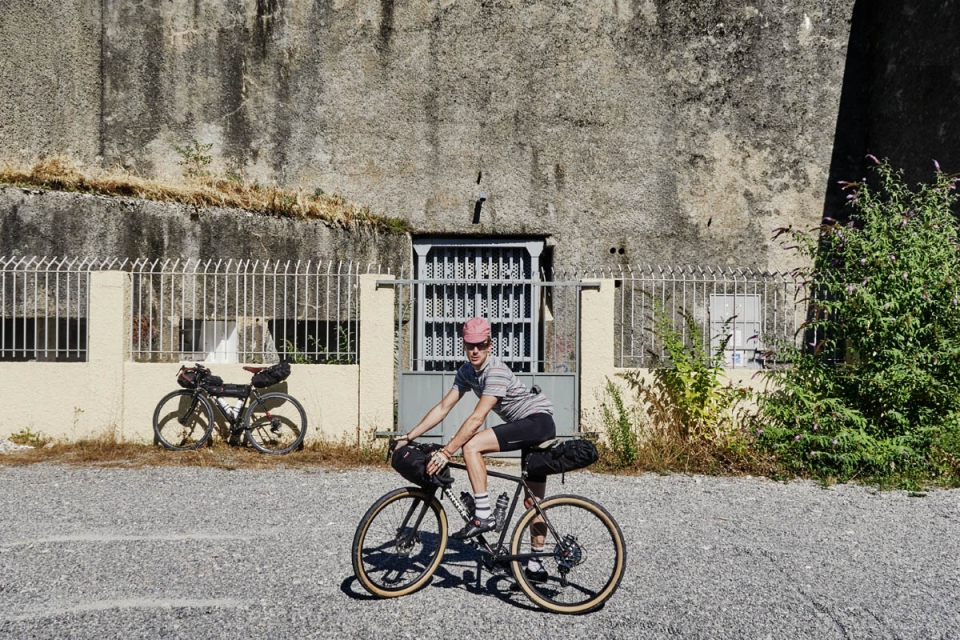
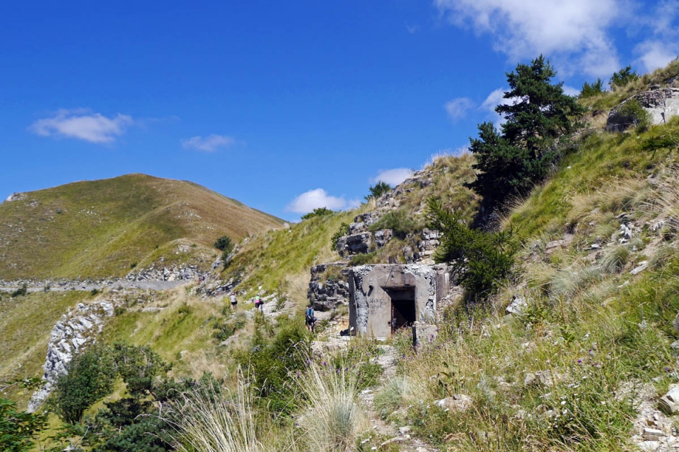
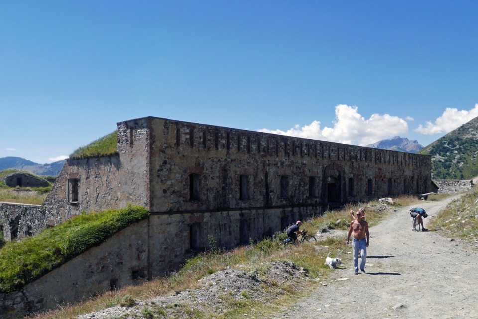
Looking back across the valley at the Ouvrage de Sainte Agnes, sited above the town like some kind of Bond villain’s lair, we could only imagine the Bunker’s network of rooms and corridors hidden inside the peak as we rumbled along the Route Strategique to the foot of our next Bunker – the sci-fi-esque Gros Ouvrage de Castillon – built between 1931-34 at a cost of 15.6m Francs to be within firing range of both the Mediterranean coastline and Sospel valley. Three Bunkers conquered at this point, Tour Guide Max wanted to show us our first entrance block; facing west, of course, away from the Italians. Looking up at the concrete cliff – geez – it’s brutal
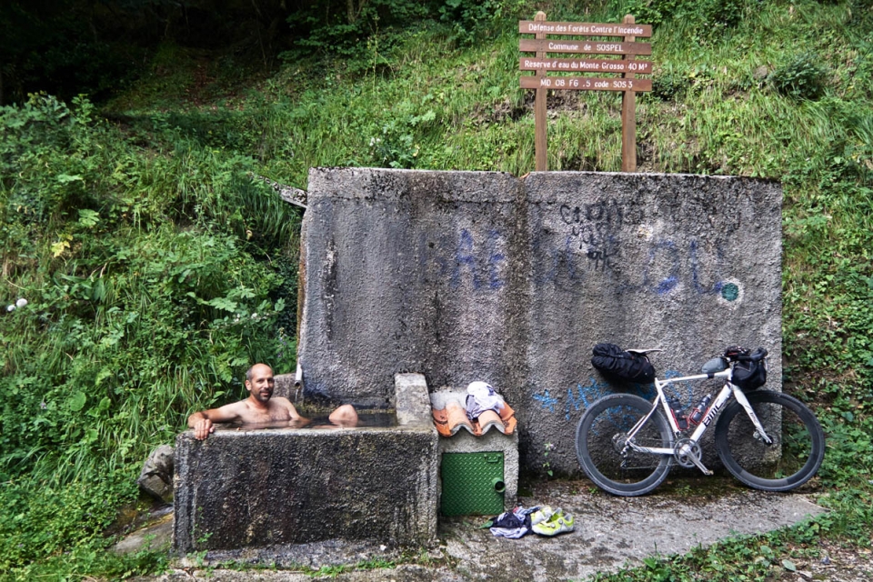
appearance was impenetrable. On a practical level we couldn’t have bridged the 3m x 5m voids, or snuck around the locked-shut heavy steel doors to enter the Bunker, however hard we fought. That was the whole point I guess. So, once we’d got over the downer that we might not actually be able to get inside any of the Bunkers, we descended into the small town of Sospel to refuel and stock-up for dinner and breakfast before all the cafes, boulangeries and boucheries shut; we weren’t 100% sure when our next supply stop would be after leaving here and heading up into remoter parts. Limited space on the bike for picking up supplies en-route is definitely one of the downsides to travelling with a minimal bikepacking luggage setup and no rack-space. However, this Alpes-Maritimes terrain demanded lightweight over luxury, and over the next 24 hours, we’d be glad for the filtered out non-essentials…
So, with Figatellu sausages stuffed in rear jersey pockets, bottles of Bunker Bourgogne vin and boulangerie pain strapped to seatpacks and Remi’s rack, and Tomme / Boursin cheese stuffed amongst inner-tubes & hipflasks in framebags, we eagerly attacked the climb to Monte Grosso as the heat and light of the day faded, to catch the Bunker complex at Golden Hour and find a Bunker Bivvy spot…
"...with bottles of Bunker Bourgogne strapped to rear racks ... we eagerly attacked the climb to Monte Grosso as the heat and light of the day faded, to catch the Bunker complex at Golden Hour and find a Bunker Bivvy spot."


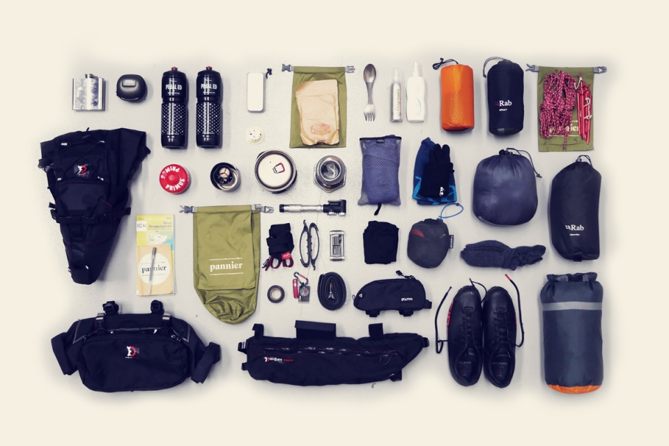
BUNKER BIVVY KITLIST
Luggage | Viscacha Seat Pack, Tangle Framebag, Sweetroll & Pocket Handlebar Pack (Revelate Designs)
Sleeping Mat | NeoAir XLite (Thermarest)
Sleeping Bag | Neutrino 200 (RAB)
Bivvy Bag | Alpine (RAB)
Down Jacket | Microlight Alpine (RAB)
Stove | MicroRocket (MSR)
Cookware | Titan (MSR), Aeropress, Spork
Warm Socks
Warm Hat
Headtorch
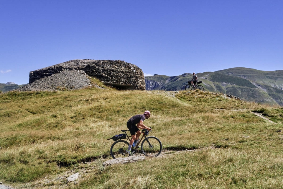
"As it turns out, Monte Grosso's steel Bunker cloches were ideal for leaning bikes against, laying kit out on, and spork drumming whilst we set up camp"
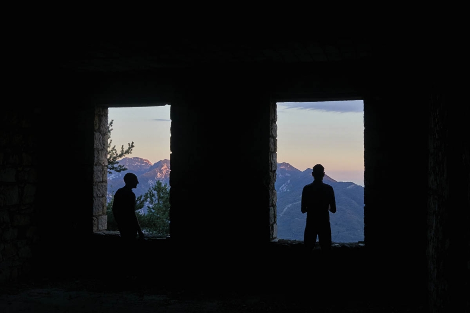
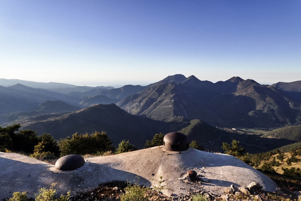
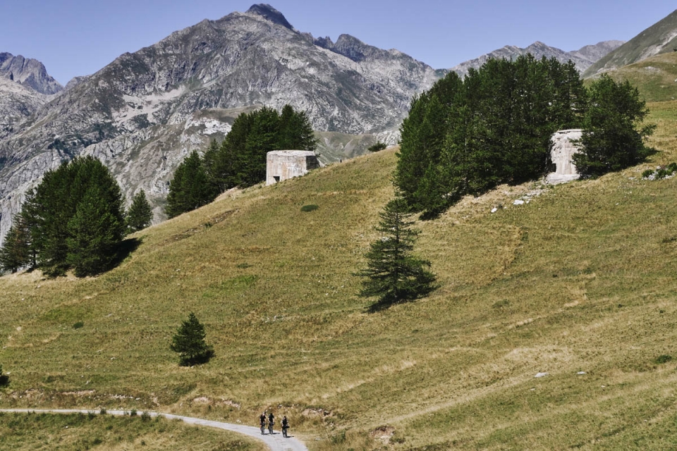
Our route up to the Gros Ouvrage de Monte Grosso was the first really obvious Route Strategique – a dead-end track snaking through a steep forested valley built for one purpose: to build and supply the military complex on the ridge. Needing to be strategic meant the military didn’t really have much choice in where Bunkers needed to be located, just that something had to be built in the area. For us, seeking Bunker specific locations often meant discovering the best vantage points, vistas and views, and Max knew the best of the best – we were visiting Monte Grosso to experience the commanding 967m height of four artillery and two observation blocks located along a ridge that faced Italy and stunning views back to the Mediterranean. The Bunker was built between 1931-35, at a cost of 40.4m Francs, to house 363 men and 10 officers. The track we rode to get there cost 4.6m Francs.
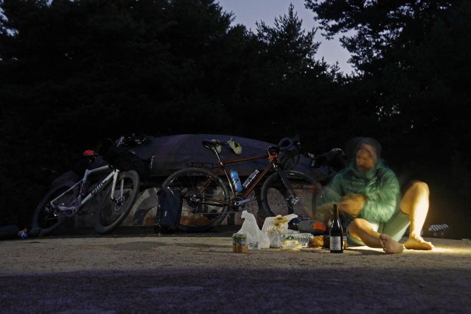
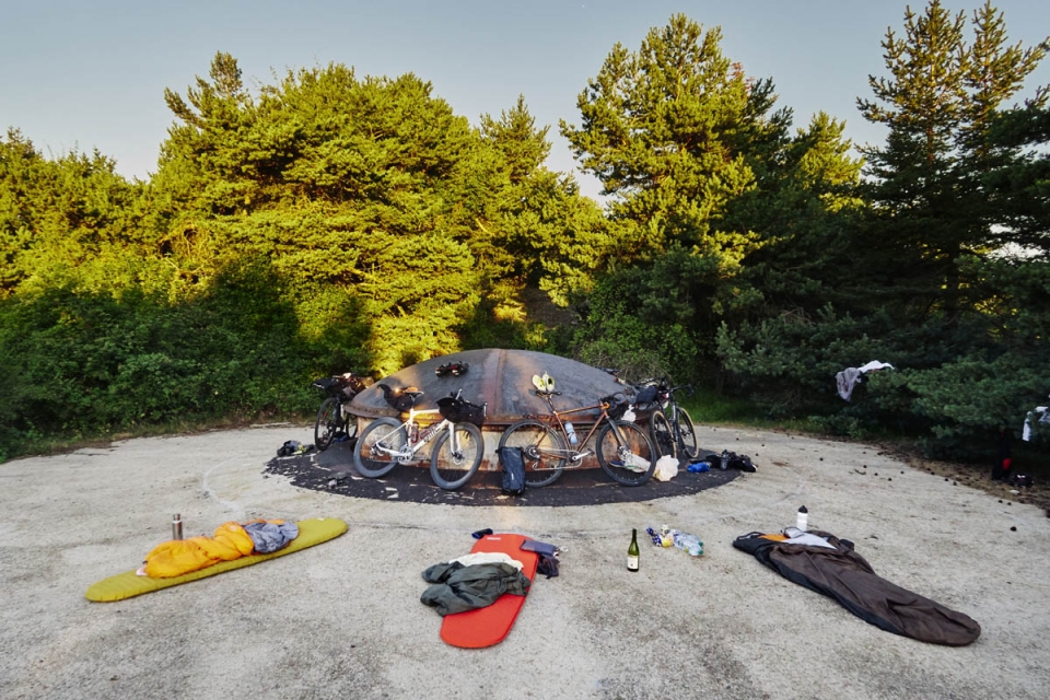
Arriving at the end of the track, we dumped the bikes against the unfinished barrack building – a carrot for so long as we climbed the track, pausing only to take our evening shower in a water trough – and explored the numerous outposts to seek a bivvy spot, as the dusky colours disappeared over the Mediterranean. As it turns out, Monte Grosso’s steel Bunker cloches were ideal for leaning bikes against, laying kit out on, and spork drumming whilst we set up camp, popped the vin, cut the pain, and spread the Boursin.
The tranquillity of the largest Bunker site in Europe was unexpected. Pre-trip thoughts about it being weird camping out on Monte Grosso didn’t even cross my mind, even when
blowing up my sleeping mat. The Bunkers are now neutralised and merged into the landscape – foliage and trees have all but grown back to shroud the outposts, having been stripped in the 1930’s to enable construction and reconnaissance. Brutal as the Bunker architecture is, part of the tranquillity must have resulted from the subconscious knowledge that the Maginot Line in this region didn’t see much action. This Bunker only fired (and was fired upon) during a single day in 1940; little enough to appreciate it as the impressive feat of engineering it was: all the road building, all the building materials and weaponry, all the time wasted manning it.
It is a lot easier to prepare for a bikepacking trip knowing the weather will be warm and dry for three days. Before we set off from the CdC cafe, Antton and I decided to test a lighter-weight bivvy setup, leaving us some room for picking up some of those group supplies en-route. We went without a sleeping bag, just wearing a down jacket and warm socks inside a bivvy bag. Max was actually the only one with the ideal overnight kit; Ali forgot his sleeping mat and Remi decided to not bring a bivvy bag. Guess who had the best night’s kip? Sleeping outside, on top of the Bunker, might seem like a bit of a missed opportunity, but we couldn’t get inside – the entrance blocks were all locked shut and the cloche openings were not much larger than my 42t chainring. So, we settled out in the open, gathering over a couple of hip flasks – Max’s Laphroaig and my Cointreau (don’t ask) – and as shooting stars whizzed across the clear night sky around us we made the communal decision to try a 4km ‘shortcut’ the next morning…


Brutal [adj.]
a ruggedness and lack of concern to look comfortable or easy
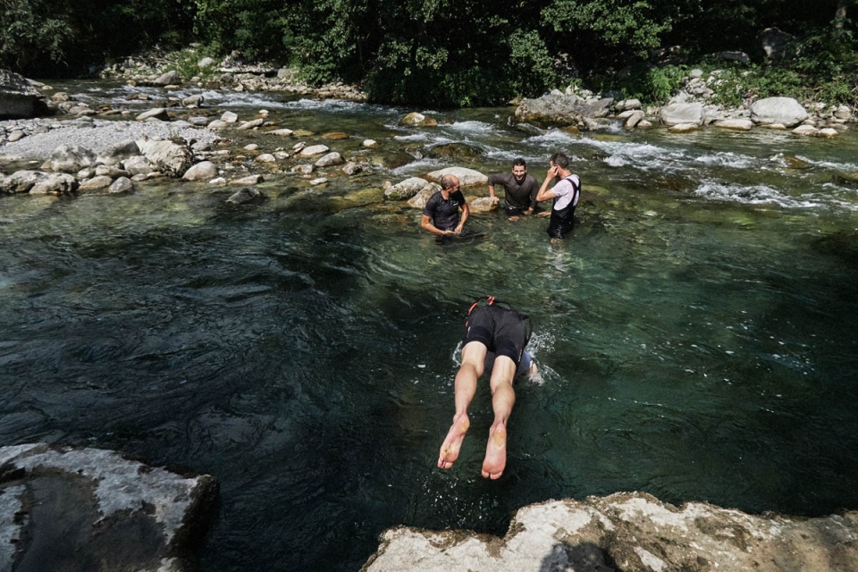
The thing is, there are no real shortcuts in the mountains. Instead of a lengthier ride that involved doubling back on ourselves, we set off from our camp spot directly onto GR hiking trails expecting a challenge of sorts. Our shortcut that morning ended up being 4km of steep forest and alpine grassland singletrack with an elevation gain of 800m, so took us a good few hours. It wasn’t until we’d found a water fountain in Briel-sur-Roya and all jumped into the cold waters of the Roya River, that we looked back on the epic ridge-line route in a positive light. In a type-two fun way, it really had been a dream morning.
Bowls of gnocci, fizzy drinks, and our IGN map covered the lunch table as we sat around re-hashing our plans; our bike/hike had sapped our ambition to reach a refuge beyond the Col de Tende that evening. Given our slowed progress, we made the decision to aim for somewhere around Casterino: a small village en-route, about 40km away. Located at 1590m, it would be a manageable ride up the Roya Valley before taking a
long but beautiful 14km road climb from St. Dalmas.
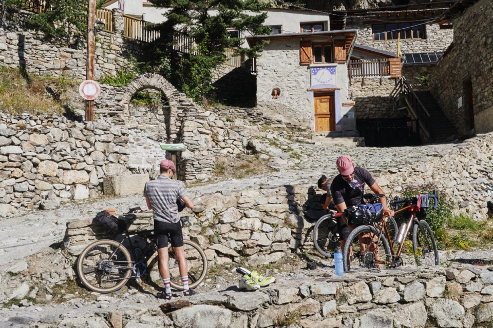
Vallauria, trapped within a steep sided valley just outside of Casterino, is an ex-mining hamlet that has been converted into ‘refuge’ style accommodation – the Gite des Merveilles . The original lead, silver and zinc mine, which once employed 300 people was closed in 1927, and shared a theme with the Bunkers – below the hamlet lay 15km of galleries; a hidden subterranean infrastructure in the mountains. It seemed like the ideal place for us to recuperate and arriving there confirmed it – the gite had the typical alpine refuge feel: setting; bunks; frugality; and hearty mountain food. Our six-course set meal came as a welcome surprise; we spent the evening in an outside communal dining area amongst other groups all discussing their day’s adventures. And they had vin rouge on tap. Crossing the crashing white river on the way back to our bunks I could sense Remi’s excitement for his trout fishing session early the next morning. I was excited too, but instead for the route that Max and Ali had in store…
“Unlike the mountains which speak to eternity, the bunkers speak of a moment … they are still watchful, entirely visible and yet invisible, neutralised and domesticated” (BR)
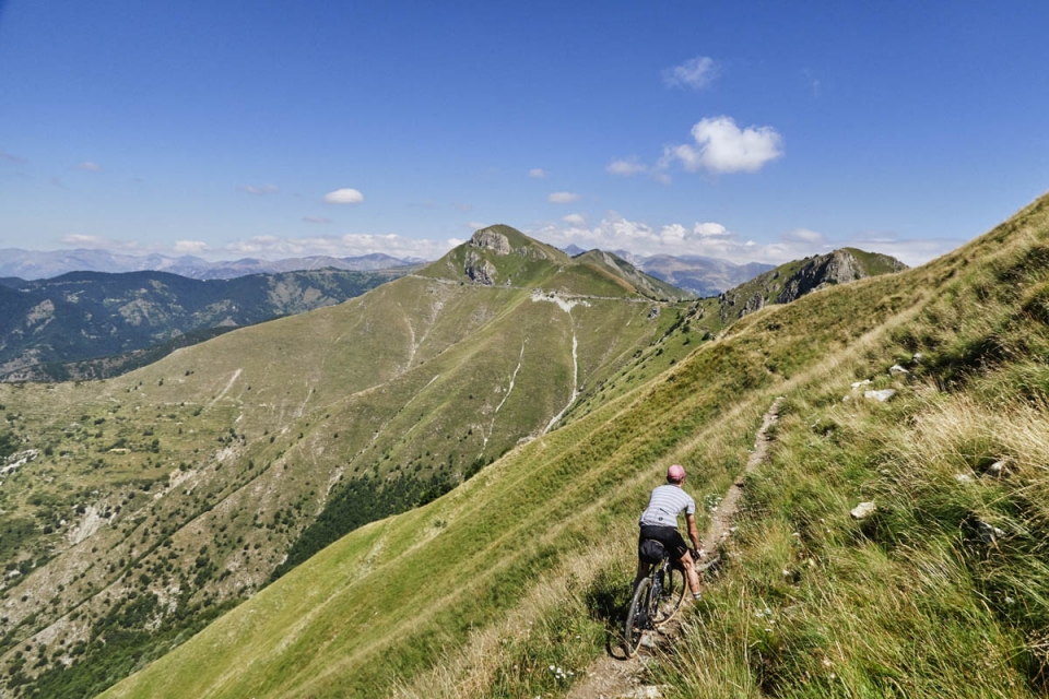
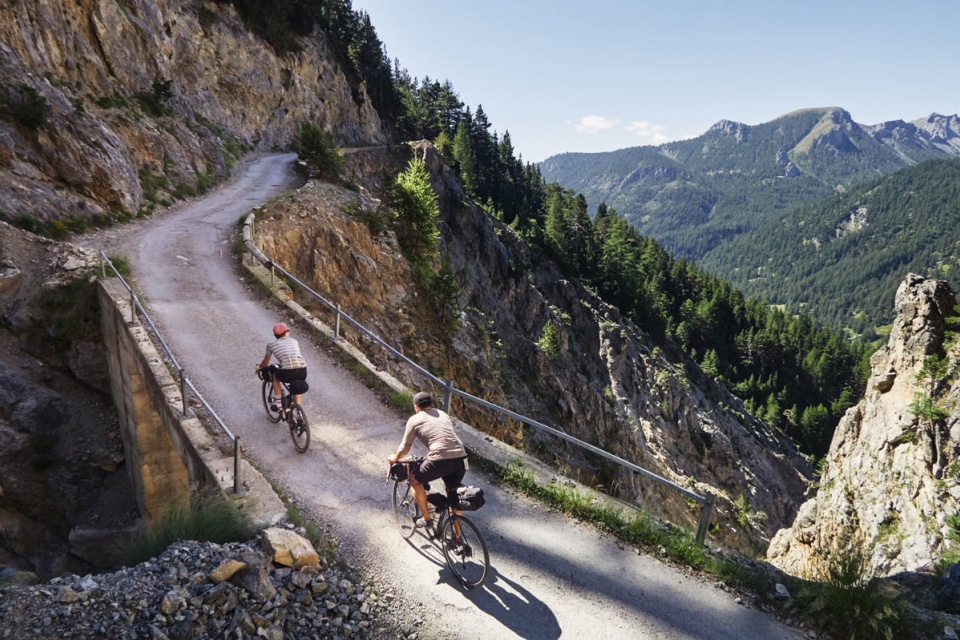
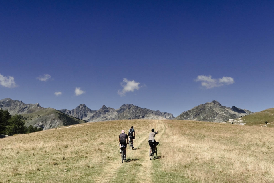
The high peaks surrounding the refuge kept us in cold shadow for most of the morning; by the time the sun rose high enough and finally hit the sun dial on the main building, we were busy packing our bikes up and hearing about how many trout Remi had caught. Our morning’s ride from Vallauria up to the Baisse de Peyferique was one of most amazing stretches of riding I’ve done for a long time. In the hot sunshine, we rode steep single-track roads up through Casterino before rounding and crossing the head of the river valley where the surfaces changed to gravel. Just us, a couple of other mountain bikers, and the odd 4×4. At this point, we were entering Italian territory in WW2, so the Bunkers that surrounded us, dotted across the Baisse de Peyferique, were Vallo Alpino fortifications built by Mussolini’s forces. Cattle bells rung and echoed around us to signal our entrance to this Bunker filled col as we rode in search of more Bunker outposts than those that lined the road-side. Alongside the Monte Grosso Bivvy, our arrival here will be a lasting memory that summed up our Bunker Research Tour.
At Baisse de Peyrefique, we were at highest point of the trip – 2000m – which marked the beginning of the end of our time in the high mountains; our last checkpoint would be the fortifications along the valley at Col de Tende, before making our way back to Nice. Riding the military ridge road to the col we noticed more and more people and heard more and more Italian, to a climax at the Chalet de Marmotte (1800m), which was heaving with Italian tourists either sunbathing post-lunch or honking at each other in the crowded car park. Pretty surreal, but given the stunning location and straightforward access road up from Limone Piemonte (Cuneo), it was clear to see why; this was no Monte Grosso Route Strategique. The Col de Tende has always been an important strategic place – the
most accessible col on the general route north/south between France and Italy, and well located on the Via Del Sale (salt route). As a result, the borders have shifted around there several times and is the reasoning behind the large Fort Central at the col, built by the Italians in the 19th century to defend such a strategic position. Post-War, the French enveloped this area for itself but the mix of Italian and French car number plates, languages, and etiquette up at the col emphasised the fickle side of this historical stronghold, and in many ways the entire border region we’d spent the last couple of days. Did the Bunker infrastructure present a deterrent for either side? Potentially, but surely not as much as the the Alpes-Maritimes terrain that already provided such an obvious natural border. Surely, the process of constructing the complex Bunker infrastructure served one purpose: to put either side off attacking across this terrain. Passive Defence in action.
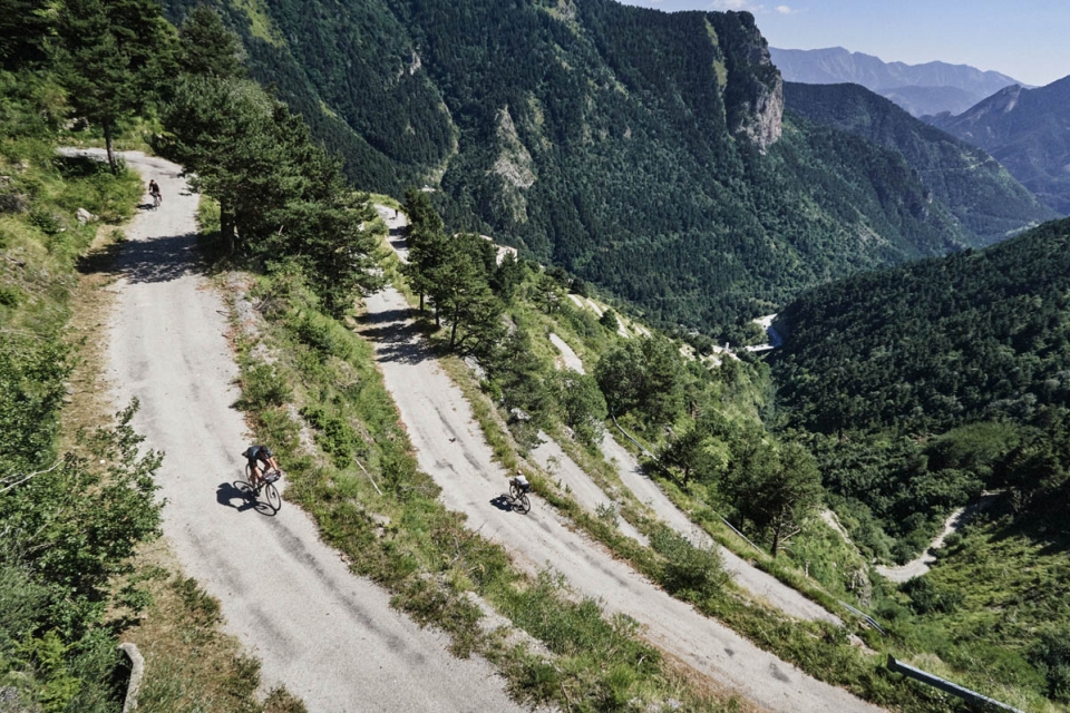
We indulged in plates of polenta and fizzy drinks at the Chalet de Marmotte before exploring the Fort Central ruins, alongside topless dogwalkers and around more sunbathers. Max disappeared; Remi found him sunbathing at the top of the snaking descent back home – his Tour Guide duties were almost over and he was starting to slack. Below us, the Col de Tende gravel road ran for 7km, around 48 hairpin bends, in order to drop the 600m to the foot of the Roya Valley. Boy, was it a fun ride to signal our exit from the high mountains. It was annoyingly technical though, so it took a bit of concentration to pick lines, whilst trying to look around at all the fortifications on the way down. Cambers in the road, deep gravel sections, and even gravel drifts that formed speed-humps didn’t faze Antton, this was his domain; never have I seen someone descend so fast on gravel.
"Some of the contracts to build French fortifications in the Alpes-Maritimes were won by Italian firms ... just one of the examples of the cockeyed logic of the war in these parts” (BR)


“As the French surrendered … the Italians took control of the bunkers, but since they served no strategic purpose, did not use them … hundreds of millions of francs, hundreds of men stranded in the dark in the mountains … for nothing.” (BR)
Knackered and dusty, the five of us arrived back at the CdC café in Nice on Sunday evening, chuffed to have ticked off our aims and visions for the trip over a challenging three days. One thing is for certain, as niche as Bunker Tour Guiding is, the Bunkers are here to stay. The irony is that you cannot easily erase a Bunker; they were designed to withstand the hardest of enemy bombardment, and yet their subterranean designs and remote locations mean that they cannot really be re-appropriated as any form of useful building either. Now decommissioned, “they are still watchful, entirely visible and yet invisible, neutralised and domesticated”, left to slowly decay and be overrun by the landscape. I like to think that intrepid cyclists in a few-hundred years time will seek out the Bunker sites, like I would seek ancient roads and ruins on maps. They, like I, might imagine the rationale (or lack of) behind them, try to understand how they worked, and what life was like there in their heyday.
With none of the serving soldiers from the Bunkers still alive, the romance of such brutal structures dotted around the mountains shines on in people’s imaginations once they’ve noticed one. It’s a slippery slope for sure – three days touring the Alpes-Maritimes with Max, and I went from being watched to the watcher, constantly on the lookout for Bunkers in such a stunning alpine theatre.
On that note, I’m off to look out for a niche tour theme to trump Max’s…
The Bikes
MAX’S STINNER
Pika Seat Pack (Revelate Designs)
Sweetroll Handlebar Pack (Revelate Designs)
Pocket Accessory Pack (Revelate Designs)
REMI’S VICTOIRE
Accessory Pack (Ortlieb)
Dry Bag – 10L (Ortlieb)
Rack Straps (Tubus)
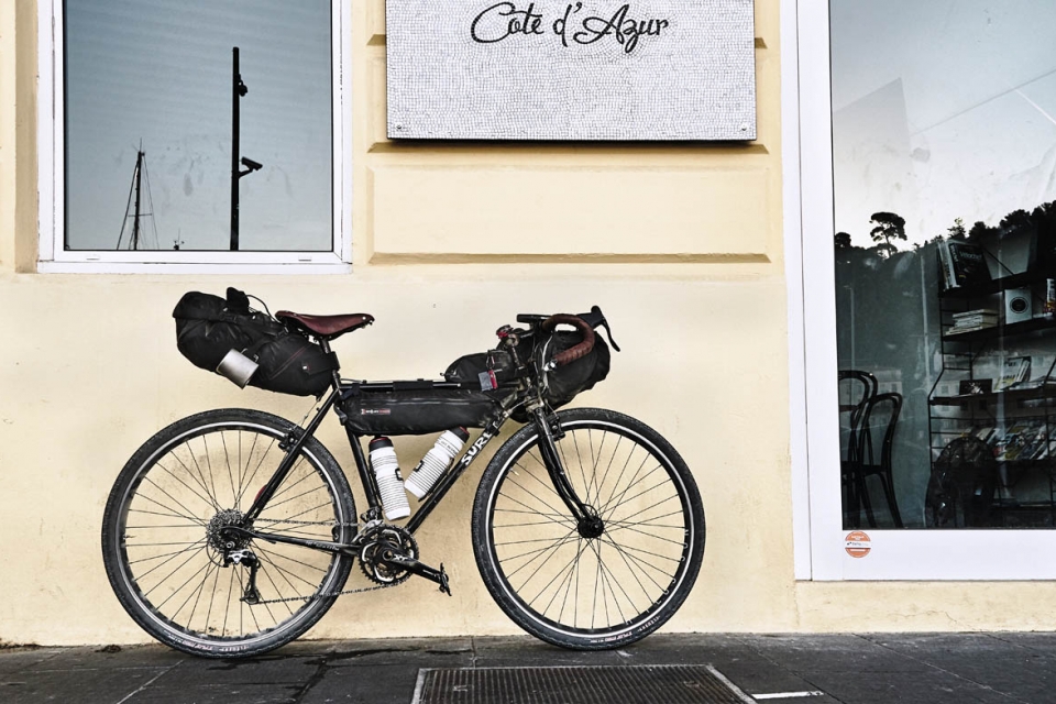
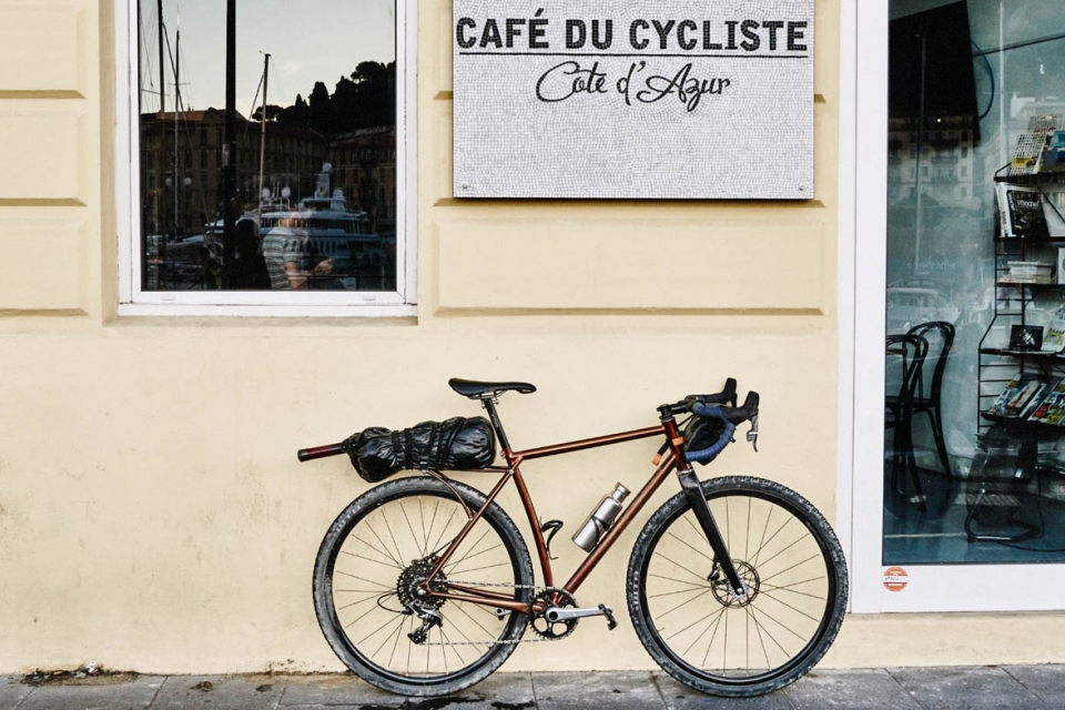
STEFAN’S SURLY
Viscacha Seat Pack (Revelate Designs)
Tangle Framebag (Revelate Designs)
Sweetroll Handlebar Pack (Revelate Designs)
Pocket Accessory Pack (Revelate Designs)
Top Tube Bag (Gramm)
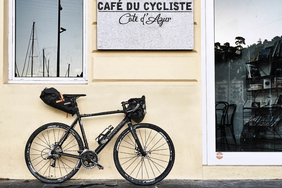
ALI’S TOMAC
Seat Pack (Ortlieb)
Handlebar Pack (Ortlieb)

ANTTON’S BMC
Viscacha Seat Pack (Revelate Designs)
Sweetroll Handlebar Pack (Revelate Designs)
Top Tube Bag (Apidura)
Stefan Amato | @panniercc
Antton Miettinen | @anttonmiettinen
__________
NOTES.
Thanks to Max Leonard for agreeing to be our Bunker Tour Guide, Café du Cycliste for the route knowledge, hospitality in Nice and clothing, and Antton for documenting our trip so seemlessly.
Map required: IGN 165 – Nice Draguignan
Bunker Research | Website & Book
Cafe Du Cycliste | Website & Cafe (Port of Nice)